
Reference The most complete and authentic Blog related to mountaineering and rock climbing
Search for:
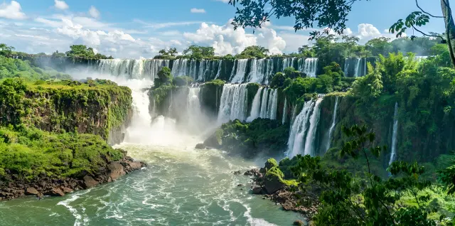
The Best Places for Nature Travel in Iran in Every Season
Iran has some of the most varied landscapes in the world, from the dense forests of the north to the quiet deserts and snow-covered mountains. But what really makes a trip enjoyable is choosing the right destination in the right season. In this guide, we look at the best nature travel destinations in Iran for each season, so you know exactly where to go and what kind of experience awaits you.
Table of Contents:
The best nature travel destinations in spring
The best nature travel destinations in summer
The best nature travel destinations in autumn
The best nature travel destinations in winter
Important tips before heading into nature
Conclusion
Frequently Asked Questions
The Best Nature Travel Destinations in Spring
Spring is the best time to see Iran's nature alive and green. The weather is usually mild, and everywhere is full of flowers and freshness. In this season, many parts of the country are at their very best, and you can head for the most attractive spring nature destinations.
Alimestan Forest
Alimestan Forest is located near Amol and is one of the most famous spring forests in Iran. With its misty views and lush green trails, it is very popular among nature lovers. Its vegetation includes hornbeam and beech trees and forest shrubs, and species such as wild boar, foxes and forest birds can be seen there. The combination of mist, green trees and the silence of the forest creates a completely peaceful atmosphere.
Kalpush Poppy Plain
This plain lies on the border between Semnan and Golestan provinces, and in spring it turns into a natural red carpet of wild poppies. Its vegetation mostly consists of rangeland plants and seasonal flowers, and small animals such as hares and plains birds can be seen there. This area is one of the most distinctive spring landscapes in Iran for photography.
Why is spring the best time for nature travel?Because the weather is mild, nature is at its greenest, and hiking routes are usually in their best condition.
The Best Nature Travel Destinations in Summer
Summer is the best time to escape the heat and head to cooler areas. In this season, many of Iran's mountain and summer-pasture regions become the best destinations for travel and nature trips.
Dar Gorge
Dar Gorge is one of the most distinctive and exciting summer destinations in northern Iran, located near Nowshahr.It is a narrow gorge with tall rock walls and a cool river flowing along its length. Its vegetation includes dense trees, mosses and moisture-loving plants, and forest birds and small animals can be seen around it.The experience of wading through cool water between tall, shaded walls makes Dar Gorge a completely different summer destination: a place where you get to touch nature and escape the summer heat at the same time.
Subatan Summer Pasture
Subatan is one of the most beautiful summer pastures in northern Iran, located in the highlands of Talesh. Its vegetation includes wide meadows, wildflowers and scattered forests. Livestock such as horses and cattle graze in the open pastures, and mountain birds are among the wildlife in the area. The weather in Subatan is pleasantly cool in summer, and the combination of mist, green meadows and wooden huts creates a dreamlike atmosphere.
Gahar Lake
Gahar Lake lies in the heart of the Oshtorankuh range and is known as the “Jewel of the Zagros.” The surroundings are covered with mountain plants and oak trees, and species such as chukar partridge, wild goat and ibex can be seen in the area. The clear water of the lake beside the mountains creates a very calm and beautiful scene.
Why is summer good for nature travel?Because you can go to cool mountain and summer-pasture areas and enjoy nature and pleasant weather without dealing with extreme heat.
The Best Nature Travel Destinations in Autumn
Autumn is the season of colors, when nature is at its most beautiful. At this time of year, many of Iran's forests and natural areas are transformed into extraordinary and distinctive landscapes.
Dohezar and Sehezar Forests
These forests lie in the highlands of Tonekabon and are among the best autumn destinations in Iran. The vegetation includes beech, maple and oak trees, which turn yellow, orange and red in autumn. Together with these colors, the autumn mist creates a completely cinematic atmosphere.
Golestan National Park
Golestan National Park is one of the oldest protected areas in Iran. The area has great plant and animal diversity, and species such as red deer, leopards and wild boar live there. In autumn, the blend of colors and the morning mist make this area truly special.
Why is autumn a good time for nature travel?Because the weather is cool and pleasant, nature is at its most colorful, and thanks to the smaller crowds, you get a calmer and more enjoyable nature trip.
Best Winter Destinations for Nature Travel
Winter offers a different and distinctive kind of nature travel experience, and it suits adventure lovers best. In this season, some parts of Iran take on a completely different look and become attractive destinations for winter trips.
Maranjab Desert
Maranjab Desert lies north of Aran and Bidgol and is one of the most famous deserts in Iran. Its vegetation is very sparse and consists of drought-resistant plants, and animals such as the sand fox live there. In winter, the desert weather becomes very pleasant, and its night sky is spectacular.
Lar Plain
Lar Plain lies on the slopes of Damavand and is completely covered in snow in winter. The area has mountain vegetation, and species such as partridges and foxes can be seen there. The silence and whiteness of the plain create a calm and unusual atmosphere.
Why is winter a good time for nature travel?Because it gives you the chance to experience true silence and peace in nature, and it puts completely different scenery in front of you: snowy mountains and quiet deserts.
Important Tips Before Going on a Nature Trip
Before any nature trip, it is best to keep a few simple but important points in mind. First of all, check the weather so that you are not caught off guard by bad conditions. Then bring essential gear such as suitable footwear, layered clothing, enough water and light snacks. Finally, choose your destination to suit the season and your physical fitness, so that the trip is both safe and more enjoyable.
Conclusion
Iran's nature has a different and distinctive face in every season. From lush spring forests to quiet winter deserts, every time of year can offer you a different experience. If you choose your destination to suit the season, your trip will be both more enjoyable and safer. Ultimately, the best time to travel is when nature is at its best.
Frequently Asked Questions
1. What is the best season for nature travel in Iran?
Spring and autumn usually offer the best conditions, but every season has its own special destinations.
2. Where should we go for a summer trip?
Summer pastures and mountain areas such as Subatan and Lake Gahar are the best options.
3. Is a trip to the desert suitable in winter?
Yes, winter is the best time for desert travel because the weather is milder.
4. Which forests in Iran are best for a trip?
Alimestan Forest, the Dohezar and Sehezar forests, and Golestan Forest are among the best options.
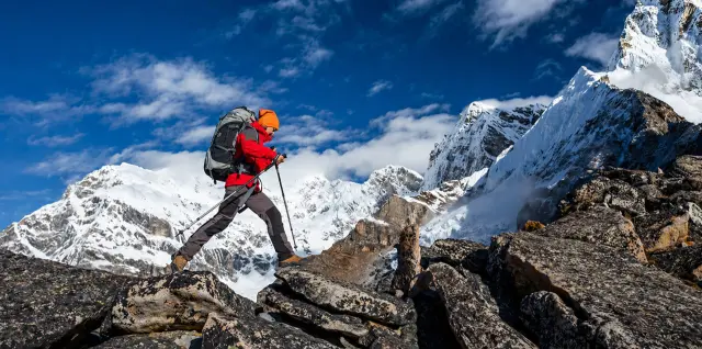
Mountaineering Hazards and How to Prevent Them
Mountaineering is one of the most rewarding nature activities, but if you don't take its risks seriously, it can quickly become a tough and even dangerous experience. The truth is that many mountain accidents happen because of a lack of awareness or because people overlook simple precautions. If you want to climb with greater peace of mind, you need to know the main mountaineering hazards and how to react in each situation.
Table of contents:
Natural hazards in mountaineering
Warning signs in the mountains
Human errors in the mountains
Essential safety tips
Safety equipment for mountaineering
Emergency actions in the mountains
Safety checklist before a climb
Conclusion
Frequently asked questions
Natural hazards in mountaineering
The mountains are a beautiful but unpredictable environment. Natural conditions can change very quickly, and if you are not prepared, they can put you in a dangerous situation.
Sudden weather changes
In the mountains, the weather can change within minutes, from sunshine to fog, rain or even snow. If you don't take this seriously, you may be caught off guard on the trail and lose visibility.
Cold and hypothermia
Hypothermia means a severe drop in body temperature. It happens when the body loses heat faster than it can produce it. Symptoms such as shivering, confusion and difficulty concentrating can be signs that it is starting.How to prevent it: Wear layered clothing, keep your body dry and carry extra warm clothes.
Falls and slips
Rocky, steep or icy routes can be very slippery. A single moment of carelessness can cause a fall.How to prevent it: Wear suitable footwear, move carefully and keep your balance.
Rockfall and avalanches
On some routes, especially at high altitude or on steep slopes, there is a risk of rockfall or avalanches.How to prevent it: Choose a safe route, check the conditions in the area and avoid crossing high-risk zones.
Lack of oxygen at altitude
The higher you go, the less oxygen there is, and you may suffer from headache, dizziness or weakness.How to prevent it: Ascend gradually and get enough rest.
Warning signs in the mountains
In the mountains, your body warns you before serious danger arises. Recognizing these signs helps you make timely decisions and prevent an accident.
The most important warning signs:
Severe dizziness
Loss of balance
Severe shivering
Shortness of breath
Severe headache (especially at altitude)
Nausea or extreme weakness
If you experience any of these signs, it is best to stop, rest and, if necessary, descend to a lower altitude.
Human errors in the mountains
A large share of mountaineering accidents are caused by poor decisions, not just by natural conditions.
Lack of planning: Setting out without checking the route, timing and weather conditions
Underestimating the route: Assuming the route is easy and ignoring its difficulty
Ignoring fatigue: Disregarding your body's warnings
Continuing in dangerous conditions: Insisting on climbing when conditions are unsuitable
Inexperienced solo climbing: Going alone without enough preparation
These simple mistakes can easily turn into dangerous situations.
Essential safety tips for mountaineering
To reduce the risks, following a few simple but important tips can make a big difference:
Check the route and weather conditions before setting out
Set a specific turnaround time
Tell a reliable person about your plan
Move at a pace that suits your ability
Turn back in time if conditions get worse
Pay attention to your body's signals
These steps help you stay more in control of the situation.
Safety equipment for mountaineering
Having the right equipment is one of the most important factors in mountaineering safety. The right gear can prevent accidents in difficult conditions.
The most important safety equipment:
Proper mountaineering footwear (to prevent slips and injuries)
Layered clothing (to regulate body temperature)
Headlamp (for emergencies)
Map or GPS (to avoid getting lost)
Enough water and food (to keep up your energy)
First aid kit (to deal with possible injuries)
Carrying this equipment means you are prepared for different situations and can make better decisions.
Emergency actions in the mountains
Even if you follow all the safety tips, you may find yourself in a situation that requires quick decisions. Knowing a few simple actions can be very helpful at such times.
In an emergency:
Stay calm and avoid rash decisions
If possible, contact the rescue services
Stay on marked routes and do not leave the trail
If you are injured, limit your movement and stabilize your condition
If the weather turns bad, find a safe place to stop
These simple actions can keep the situation from getting worse and increase the chances of getting help.
Safety checklist before a climb
Before starting any mountaineering trip, run through these items quickly so you can set out better prepared:
Have I checked the weather?
Are the route and schedule clear?
Do I have the essential equipment with me?
Have I packed enough water and food?
Have I told a reliable person about the plan?
Have I set a specific turnaround time?
If your answer to these questions is "yes", you are probably ready for a safe climb.
Conclusion
For all its beauty and appeal, mountaineering can also involve serious risks. Understanding these dangers and following safety guidelines is the most important step toward a safe climb. If you take natural conditions seriously, avoid common mistakes and carry the right equipment, you can enjoy the experience with greater peace of mind. Above all, the most important rule in mountaineering is this: safety always matters more than reaching the summit.
Frequently Asked Questions
1. What is the biggest danger in mountaineering?
It is a combination of natural conditions and human error, but lack of preparation is the biggest risk factor.
2. What exactly is hypothermia?
It is a severe drop in body temperature caused by cold and getting wet, and it can be extremely dangerous.
3. Is mountaineering without proper equipment dangerous?
Yes. Even on easy routes, conditions can change and catch you by surprise.
4. When should we turn back?
When the weather turns bad, your body is exhausted, or the situation gets out of control.
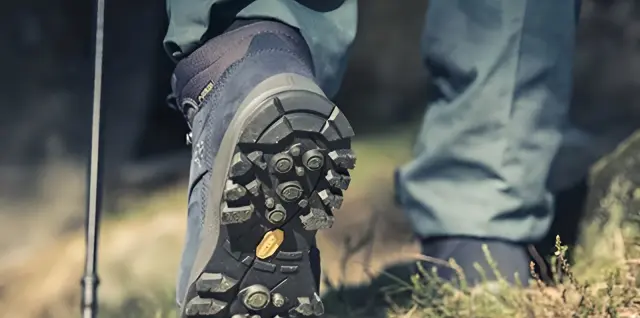
The Best Hiking Boots in 2026 + A Complete Buying Guide
If there is one piece of gear that is truly vital in mountaineering, it is without doubt your hiking boots. A wrong choice can very quickly lead to blisters, severe fatigue or even injury. A good pair of boots, on the other hand, can make a climb easier, safer and more enjoyable. In this hiking boot buying guide, you will learn exactly which boots suit you and what to look out for when buying.
Table of contents:
Types of hiking boots
Features of a good hiking boot
How to choose the right hiking boot size
Common mistakes when buying hiking boots
The best hiking boot brands
What is the difference between men's and women's hiking boots?
Quick checklist for buying hiking boots
Conclusion
Frequently asked questions
Types of hiking boots
Hiking boots are divided into several categories based on the type of route and its difficulty:
Light boots (Hiking)
These are suited to short, easy routes. They are comfortable and lightweight, but not a good choice for difficult routes.
Trekking boots (Trekking)
Designed for long and moderately demanding routes, they strike a good balance between comfort and durability.
Heavy boots (Mountaineering)
These are made for professional, snow and ice climbs. These models are very durable, heavy and highly specialised.
Features of a good hiking boot
To choose a good pair of boots, pay attention to several important features:
A durable, non-slip sole (such as Vibram) to help you keep your balance
Waterproofing to keep moisture out
Good ventilation to reduce foot sweat
A high shaft to protect the ankle
The right size (with a little free space for the toes)
Balanced weight (neither too heavy nor too light)
A good boot should be comfortable and also protect your feet in harsh conditions.
How to choose the right hiking boot size
Choosing the right size in hiking boots is far more important than you might think. The wrong size can cause blisters, pain or even damage to your toenails.
To choose the right size, keep these points in mind:
Measuring your foot: It is best to measure the length of your foot accurately and choose based on the brand's size chart.
Try boots on in the evening: Your feet swell slightly over the course of the day, so trying boots on in the evening helps you choose more accurately.
Space in front of the toes: There should be a little free space in front of your toes so that your foot does not push forward on steep routes.
Finally, the boot should neither be loose on your foot nor too tight; fit is the most important criterion.
Common mistakes when buying hiking boots
Many people make mistakes when buying hiking boots that later cause problems on the trail:
Choosing boots based on looks alone
Buying a size that is too tight or too loose
Not considering the type of route
Not trying the boots on before buying
Not wearing suitable socks
Buying cheap, low-quality boots
These mistakes can completely ruin your hiking experience.
The best hiking boot brands
There are many different brands on the market, but some stand out for their quality and popularity:
Salomon – lightweight, comfortable and well suited to trekking trails
La Sportiva – professional-grade and suited to difficult climbs
Scarpa – durable and high quality
The North Face – a blend of design and performance
Columbia – affordable and suitable for beginners
The brand matters, but what matters even more is that the boot fits your foot perfectly.
What is the difference between men's and women's hiking boots?
Women's and men's hiking boots don't differ only in appearance; they are designed around different foot shapes. Women's boots are usually narrower, have a different arch, and are shaped to better match the female foot.
Men's models, by contrast, are usually wider and larger. Choosing a model that matches your foot shape means more comfort and less fatigue or risk of injury on the trail.
Quick checklist for buying hiking boots
Before buying a pair of boots, run through these points quickly to make a more confident choice:
Are the boots completely comfortable?
Is the size right, without pressing on your foot?
Is there enough room in front of your toes?
Is the sole suitable for the intended route?
Do the boots stay firmly in place without feeling loose?
Is the weight well balanced?
If the answer to most of these questions is “yes,” you have probably made the right choice.
Conclusion
Choosing the right hiking boots is one of the most important decisions, directly affecting your comfort, safety and the quality of your experience in the mountains. If you understand the type of trail, the features of the boots and the common mistakes, you can make a more precise choice. Always remember that comfort and fit matter more than the brand or the price.
Frequently asked questions
1. What is the most important feature of a hiking boot?
Comfort and fit are the most important factors.
2. Are expensive boots always better?
No. What matters is that the boots suit your needs.
3. What boots are suitable for starting out?
Trekking shoes are the best option for beginners.
4. Should hiking boots be high-cut?
For mountain trails, high-cut boots are better because they protect your ankles.
5. When should we replace our hiking boots?
When the soles are worn down or the boots have lost their comfort.
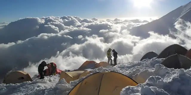
How to Choose the Right Hiking and Mountaineering Tour + Key Tips Before Booking
If you have ever thought about joining a mountaineering tour but didn't know which option suited you best, you're not alone. Choosing the right mountaineering tour is one of the most important decisions you can make, and it can mean the difference between an enjoyable, safe experience and a difficult, risky trip. In this guide, you'll learn how to make the best choice by understanding the different types of tours, difficulty levels and the organizer's reputation, so you can head into the mountains with confidence.
Table of contents:
Types of mountaineering tours
Beginner vs. professional mountaineering tours
Gear you need for a mountaineering tour
Key tips before booking a tour
How much does a mountaineering tour cost?
Checking the organizer's credibility
Conclusion
Frequently asked questions
Types of mountaineering tours
Mountaineering tours fall into several categories depending on difficulty, duration and type of activity:
Day tours
These suit easy routes and beginners. They are usually run without an overnight stay.
Multi-day tours (camping)
These include staying in a tent or a mountain shelter and require more equipment.
Summit climbing tours
The main goal of these tours is to reach the summit, and they usually require a higher level of physical fitness.
Mountain nature tours
These tours are lighter than professional mountaineering and are mostly organized for the purpose of enjoying nature.
Beginner vs. professional mountaineering tours
It is very important to understand the difference between these two types of tours, because a wrong choice can be dangerous.
Beginner tour:
Short, gently sloping routes
Slower pace
Simple equipment
Suitable for people with no experience
Professional tour:
Long and challenging routes
High level of physical fitness required
Specialized equipment
Includes technical climbs
If you are new to this, it's best to start with easier tours and gradually raise your level over time.
Gear you need for a mountaineering tour
Having the right gear is very important when joining a mountaineering tour. Even if the tour is run as a group, much of the equipment you need is your own responsibility. Choosing it well helps you move more comfortably and avoid problems along the way.
Essential gear for a mountaineering tour:
Comfortable, suitable hiking boots
A light, good-quality backpack
Enough water and energy-boosting snacks
Suitable clothing (layering system)
Trekking poles (if needed)
Headlamp or flashlight
Sunscreen and sunglasses
Before the tour begins, it's best to get the list of required equipment from the organizer so you don't forget anything.
Key tips before booking a tour
Before signing up for any tour, it's best to check the following:
The difficulty level of the route and how well it matches your physical ability
The detailed tour schedule (departure time, route and stops)
Required equipment
Weather conditions at the time of travel
Group size
The presence of a professional guide (leader)
These points help you make a more informed choice and avoid possible problems.
How much does a mountaineering tour cost?
The cost of a mountaineering tour varies depending on different conditions, and no single fixed price can be given. Tour prices are usually determined by several main factors.
The most important factors affecting the cost:
Route and destination (easy or technical)
Tour duration (one day or several days)
Type of accommodation (none, tent or mountain shelter)
Transport (public or private vehicle)
Services provided (guide, insurance, meals, etc.)
In general, the higher the level of services and the more demanding the program, the higher the cost of the tour. When choosing, don't look only at the price; put the quality of services and safety first.
How do you check the organizer's credibility?
One of the most important parts of choosing a tour is checking the organizer's credibility.
Things to check:
Having an official operating license
A track record of successful tours
Reviews from previous participants
The presence of a trained guide
Insurance for participants
Never look only at a low price; a cheap but unprofessional tour can be very risky.
Conclusion
Choosing the right mountaineering tour is not just about finding a cheap or nearby program; you also need to consider your ability level, the type of route, the quality of services and the organizer's credibility. If you take some time to check the details before booking, you'll have a safer experience and be far more likely to enjoy the trip.
Frequently asked questions
1. Are mountaineering tours suitable for beginners?
Yes, as long as you choose a tour that matches a beginner's level.
2. How do I know if a tour is right for me?
Check the difficulty level of the route and compare it with your own physical ability.
3. Is joining a tour safer than climbing solo?
Yes, especially for beginners, a tour is usually the safer option.
4. How much does a mountaineering tour cost?
It varies depending on the type of tour, the route and the services provided.
5. Is equipment provided on the tour?
Some tours provide equipment, but personal gear is usually the participant's responsibility.
How to Start Mountaineering: A Complete Guide for Beginners
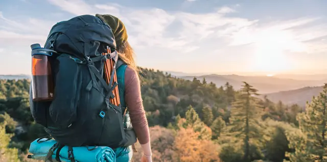
If you've ever looked up at a mountain and thought, "I wish I could climb that," you should know that getting started in mountaineering isn't all that complicated, but it isn't easy without some planning either.
Mountaineering combines physical fitness, an understanding of nature and the right choice of gear. In this beginner's guide, you'll learn step by step how to get into this exciting sport safely and the right way.
Table of contents:
What is mountaineering and why does it matter?
First steps to get started in mountaineering
The best season to start mountaineering
Essential gear for beginners
How much does it cost to start mountaineering?
Common mistakes when starting out
Conclusion
Frequently asked questions
What is mountaineering and why does it matter?
Mountaineering isn't just about climbing to a high point; it's a combination of exercise, nature travel and a mental challenge. It builds physical endurance, improves heart health and reduces stress.
More importantly, mountaineering teaches you how to make decisions in difficult conditions and how to work in harmony with nature. That's why it's more than a pastime: it can become a way of life.
First steps to get started in mountaineering
You shouldn't start mountaineering with hard routes. The right path always goes from easy to difficult.
First steps:
Choose short, easy routes (such as hills or low-altitude mountains)
Go with experienced people or mountaineering groups
Learn the basics of navigation and safety
Build up your fitness gradually (walking and aerobic exercise)
Check the weather conditions before every climb
The key point is that rushing is one of the biggest mistakes beginners make in mountaineering.
The best season to start mountaineering
Choosing the right time to start is very important, especially for beginners. Spring and summer are usually the best seasons to begin, because the weather is more stable and the routes are safer and more predictable.
In these seasons, you are less likely to face cold, snow and harsh conditions, so you can focus more on learning and gaining experience. Starting mountaineering in autumn and winter requires more gear and more experience, so at the beginning it's better to start with easier conditions.
Essential gear for beginners
You don't need professional, expensive equipment to start mountaineering, but a few basic items are essential:
Suitable, comfortable hiking boots
A lightweight backpack
Enough water bottles
Suitable clothing (layered and moisture-wicking)
A headlamp or flashlight
Light, energy-rich snacks
A small first aid kit
Having the right gear makes your first experience safer and more enjoyable.
How much does it cost to start mountaineering?
One common question for people starting out is whether this sport is expensive. The truth is that you don't need to buy costly equipment to begin. With a few basic items, such as good boots, a light backpack, comfortable clothing and a few essential tools, you can get started at a reasonable cost.
If you want to continue at a more serious level, costs will naturally rise, but at the start you can get much of your gear affordably or even borrow some of it. What matters more than cost is choosing practical, suitable items, not how expensive they are.
Common mistakes when starting out
Most problems at the start of mountaineering come from simple but important mistakes:
Choosing hard routes at the beginning
Carrying too little water and food
Ignoring the weather conditions
Wearing unsuitable footwear
Starting without physical preparation
Going to the mountains alone in the early days
Paying no attention to the turnaround time
If you recognize these mistakes and avoid them, your mountaineering experience will be much safer.
Conclusion
Getting started in mountaineering doesn't have to be hard or complicated, but it does require awareness and a good start. If you choose easy routes, carry the basic gear and gain experience gradually, you can move into the more serious side of mountaineering very quickly.
The most important thing is not to rush, and to let your body and mind adapt to mountain conditions over time.
Frequently asked questions
1. Do I need to be very athletic to start mountaineering?
No, you don't need to be a professional, but a moderate level of fitness, such as regular walking, helps a lot and makes the route easier and safer.
2. What is the best age to start mountaineering?
You can start at almost any age, though teenagers and young adults have an easier time because of their better physical capacity.
3. Can I start mountaineering alone?
It isn't recommended, because at the beginning you don't have enough experience to manage the risks, and it's better to go with a group or an experienced person.
4. How long does it take to become an expert?
Depending on training and experience, it usually takes anywhere from a few months to a few years.
5. What is the most important tip for beginners?
Start slowly, choose easy routes and increase the difficulty of your trips gradually.
Hiking Backpack Buying Guide: Key Tips for Choosing the Best Model
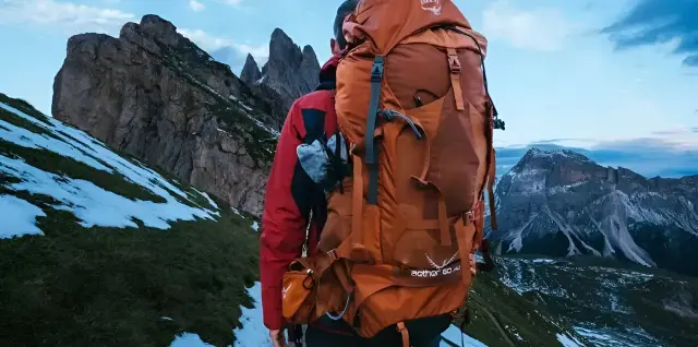
If there is one piece of gear in mountaineering that directly affects your comfort, your energy and even your safety, it is without doubt your hiking backpack. The wrong pack can quickly lead to fatigue, shoulder and back pain, and even reduce your balance on difficult routes.
A proper, well-designed pack, on the other hand, distributes the weight correctly and lets you cover the trail with more energy and control. Choosing a backpack is not just buying a piece of equipment; you are defining your style of moving in the mountains.
Table of Contents:
Types of hiking backpacks
Why does choosing a backpack matter?
Popular brands and models
The right backpack capacity
Key features of a good backpack
Common mistakes when choosing a backpack
Conclusion
Frequently asked questions
Types of hiking backpacks
Hiking backpacks are divided into several main categories based on how they are used and how long your trip is. Choosing the right type of pack is the first step toward a comfortable experience in the mountains.
1. Small backpacks (Daypack)
These models usually have a capacity of 10 to 30 liters and are suited to day trips or light outings. Their low weight and simple design make them a comfortable choice for short routes.
2. Medium backpacks
Packs of 30 to 50 liters are used for trips of one to two days. These models have enough space for extra clothing, food and essential equipment.
3. Large backpacks (Backpacking)
Packs of 50 liters and above are designed for multi-day or professional trips. These models have a more advanced carrying system and distribute the weight better across your body.
Why does choosing the right type of backpack matter?
Choosing the wrong backpack means either your gear won't fit properly, or the pack will be too heavy and hard to control. Every trip has its own suitable pack, so before choosing, you need to define what kind of trip you are planning.
Popular hiking backpack brands and models
Choosing a reputable brand is very important when buying a hiking backpack, because it directly affects comfort, durability and safety. Brands such as Osprey, Gregory and Deuter are among the most popular options.
Backpacks for women
Osprey Aura AG 50: One of the best choices for women, with an advanced Anti-Gravity suspension system that distributes weight well and reduces pressure on your lower back.
Gregory Deva 60: A professional pack with a design shaped to fit the female body, offering good comfort on multi-day trips.
Osprey Eja 58: A lighter model for those who want to reduce pack weight on long trips.
REI Co-op Flash 55 (Women’s): A more economical option, lightweight with a simple but practical design, for medium and light trips.
Backpacks for men
Gregory Baltoro 65: One of the most famous models for carrying heavy loads on long, professional trips.
Osprey Atmos AG 65: A very popular model with excellent ventilation and weight distribution for hard, long routes.
Deuter Aircontact Lite 50+10: A sturdy pack suited to heavy trips, focused on durability and comfort when carrying a large load.
Osprey Aether 65: A classic and powerful option for professional multi-day mountaineering.
What is the right backpack capacity?
Pack capacity should be chosen based on the length of your trip and the type of equipment:
Trips of a few hours: 10 to 20 liters
Day trips: 20 to 30 liters
Light two-day trips: 30 to 45 liters
Multi-day trips: 50 liters and above
But capacity is not the only thing that matters; how you organize your gear also plays an important role. A small but well-organized pack can perform better than a large, disorganized one.
Key Features of a Standard Backpack
A good backpack isn't just for carrying gear; it should also support your body and distribute the load properly.
The most important features:
A back ventilation system to reduce sweating
Adjustable shoulder and waist straps for weight distribution
A hip belt to take pressure off the shoulders
Practical pockets with quick access
Water-resistant, abrasion-resistant material
A suitable weight for the pack itself
A good backpack should spread the weight across your shoulders, waist and hips, rather than putting all the pressure on your shoulders.
Why Is the Load-Carrying System Important?
If all the weight rests on your shoulders, you will tire quickly, and your balance on difficult trails may even suffer. A proper carrying system helps you conserve energy along the route and move more comfortably.
Common Mistakes When Choosing a Backpack
Many people, especially beginners, make mistakes when choosing a backpack that later cause problems on the trail.
The most important mistakes:
Choosing a backpack based only on looks
Buying a large backpack without a real need
Ignoring your body shape
Overlooking the ventilation system
Not trying the backpack on before buying
Choosing a heavy backpack even before filling it
Overfilling the backpack
Is a High Price Always a Sign of Quality?
Not necessarily. Some backpacks cost more simply because of the brand, yet they may not suit your needs. It's better to choose based on comfort and the type of trip, not just price.
Conclusion
In mountaineering, a backpack is not just a way to carry a load; it is one of your most important pieces of equipment and directly affects your comfort and performance. The right choice can give you a comfortable, safe experience, while the wrong one can affect your entire trip.
By understanding the types of backpacks, paying attention to the right capacity, checking the standard features and avoiding common mistakes, you can make a precise, well-informed choice.
Frequently Asked Questions
1. What capacity is suitable for a one-day hike?
A 20 to 30 litre backpack is usually the best choice.
2. Is a lightweight backpack better?
Yes, less weight reduces fatigue and strain on the trail.
3. How do I know if a backpack fits my body?
The weight should rest on your waist and hips, and the straps should be adjustable.
4. Does a backpack need to be waterproof?
Yes, it should either be waterproof or at least come with a rain cover.
5. What is the best brand of mountaineering backpack?
Osprey, Gregory and Deuter are among the most reputable brands.
6. Are women's backpacks different?
Yes, they are designed to fit the female body shape.
7. What kind of backpack is suitable for starting mountaineering?
Lightweight models such as the Osprey Eja or REI Flash are good options.
Complete Guide to Climbing Damavand: Routes, Costs and Key Tips
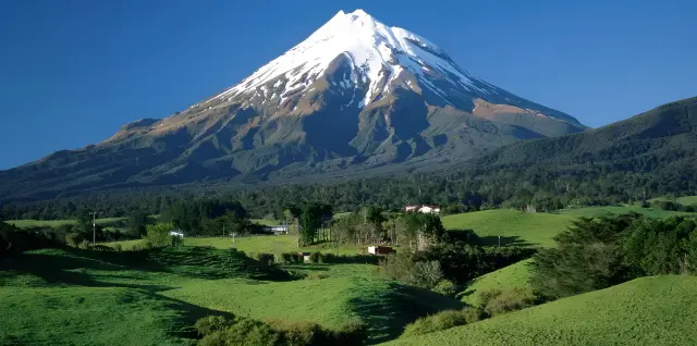
Climbing Damavand is more than just another mountaineering trip; it is a serious, challenging and unforgettable experience. At 5,610 meters, Damavand is not only the highest peak in Iran but also the highest volcano in Asia.
However, without knowing the routes and weather conditions, and without proper physical fitness, this climb can be very dangerous. In this complete Damavand climbing guide, we cover everything from routes to costs and safety tips.
Table of contents:
Damavand climbing routes
Best time to climb
Cost of climbing Damavand
Important safety tips
Conclusion
Frequently asked questions
Damavand Climbing Routes (The Best Routes)
Damavand has several main climbing routes, each with its own difficulty level and特 characteristics. Choosing the right route has a big impact on the quality and safety of your climb.
South Route (The Most Suitable Route)
This is the most popular and safest climbing route. Mountain huts such as Bargah-e Sevom (Camp 3) have led most climbers to choose this route.
North Route
This is a harder, less-traveled route that requires a high level of fitness and more experience.
West Route
This route is quieter and relatively more technical, and is usually better suited to semi-professional climbers.
Northeast Route
One of the longest and hardest routes, used mostly for professional climbs.
Best Time to Climb Damavand
The best time to climb Damavand is usually from late Khordad to early Shahrivar (mid-June to late August). During this period:
The weather is more stable
There is less snow and ice
The chance of storms is lower
In autumn and winter, climbing is recommended only for professional, well-equipped teams, because conditions are very harsh and risky.
Cost of Climbing Damavand
The cost of climbing Damavand varies depending on the type of trip and the level of equipment, but it usually includes the following:
Transport to Polur or Reyneh
Hut fees (Bargah-e Sevom)
Guide (if needed)
Equipment rental or purchase
Food and nutrition
Mountaineering insurance
In total, for a typical trip you should budget around 10 to 25 million tomans. More professional trips, or those with a guide, will naturally cost more.
Important Safety Tips for the Climb
Damavand is not an easy peak, and following safety guidelines is absolutely essential:
Take acclimatization seriously
Carry enough water
Do not leave the marked routes
Check the weather forecast before the climb
Pay attention to the symptoms of altitude sickness
Avoid climbing alone
Carry complete and suitable equipment
Ignoring these points can lead to dangers such as severe altitude sickness or getting lost.
Conclusion
Climbing Damavand is a special and unforgettable experience, but it also requires preparation, planning and awareness. Choosing the right route, the right time, full equipment and following safety guidelines play a decisive role in the success of this climb.
If you set out without sufficient preparation, you face a high level of risk. On the other hand, if you follow the basics, climbing Damavand can become one of the best mountaineering experiences of your life.
Frequently Asked Questions
1. Is climbing Damavand suitable for beginners?
No, Damavand is not suitable for beginners. It requires previous experience on easier mountains and good physical fitness.
2. What is the hardest route on Damavand?
The north and northeast routes are the hardest because of their steep slopes and technical conditions.
3. How many days does it take to climb Damavand?
It usually takes 2 to 3 days, including acclimatization and the final summit climb.
4. Can you climb Damavand without a guide?
Yes, but this is recommended only for experienced climbers, and it carries a high risk for beginners.
5. What is the biggest danger on Damavand?
Altitude sickness and rapid weather changes are the most important dangers on this peak.
Mountaineering Gear Checklist: Everything You Need for a Safe Climb
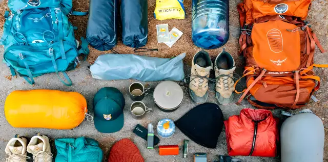
If you have climbed even once, you probably know that forgetting one simple item can throw off your whole plan. A complete mountaineering gear checklist not only keeps you organized, but also lets you tackle the route with greater peace of mind.
Whether you are a beginner or an expert, choosing the right equipment makes the difference between an enjoyable climb and a hard, risky experience. In this article, we review all the gear you need for mountaineering in 2026.
Table of contents:
Essential mountaineering gear for beginners
Professional mountaineering equipment
Gear you need for camping in the mountains
Common mistakes when choosing mountaineering gear
Conclusion
Frequently asked questions
Essential mountaineering gear for beginners
If you are new to the world of mountaineering, you don't need to go straight for professional, expensive equipment. But there are a few basic items whose absence can cause problems.
The most important essentials include the following:
Standard, non-slip hiking boots
Suitable boots should be comfortable, durable and preferably waterproof, so that you keep your balance on rocky and slippery trails.
Lightweight, ergonomic backpack
Your backpack should distribute weight well and should not be oversized for day trips.
Water bottle or hydration bladder
Always carry enough water; dehydration is one of the common dangers in mountaineering.
Suitable clothing (layering system)
Layered clothing helps you regulate your body temperature in different conditions.
Headlamp or flashlight
It is absolutely essential for emergencies or when the trail gets dark.
Map or GPS
Having a defined route minimizes the chance of getting lost.
First aid kit
A simple kit can be vital in an emergency.
The important point is that in mountaineering, safety and comfort always take higher priority than keeping your gear light.
Professional mountaineering equipment
When you head onto harder routes or higher altitudes, professional equipment becomes more important. This gear is usually used on more serious climbs:
Crampons: for moving on snow and ice
Ice axe: for keeping your balance on icy slopes
Gore-Tex clothing: waterproof and windproof to keep your body warm
Professional sub-zero sleeping bag: suitable for overnight stays in the cold
Mountaineering gas stove: for heating food at altitude
Sunglasses with strong UV protection: protect your eyes from intense light
Rope and safety equipment: for technical and specialized routes
Gear you need for camping in the mountains
Many climbers spend the night in the mountains at high altitudes, so camping gear is an important part of the plan.
Essential camping gear includes the following:
Windproof and waterproof mountaineering tent: lightweight and resistant to harsh conditions
Insulated sleeping pad: prevents the cold from the ground from reaching you
Season-appropriate sleeping bag: suited to the ambient temperature
Small stove and fuel: lightweight and fuel-efficient for use in the mountains
Lightweight eating utensils: for easier carrying
Camp lantern: provides light at night
Dried, lightweight food: such as nuts and ready-made meals
When camping, keeping your gear light and compact is very important.
Common mistakes when choosing mountaineering gear
Many problems in mountaineering come down to choosing the wrong equipment.
The most common mistakes:
Not carrying enough water
Choosing unsuitable footwear
Starting the route too late
Not having a map or GPS
Wearing non-layered clothing
Ignoring the weather conditions
Overloading the backpack
Conclusion
Having a complete mountaineering gear checklist is one of the simplest yet most important things you can do before any trip. Choosing the right equipment both improves your safety and makes your climb easier and more enjoyable.
It doesn't matter whether your route is easy or advanced; what matters is that you carry the necessary gear for the conditions and avoid the common mistakes in choosing equipment. Ultimately, a successful trip begins before the climb itself, with proper preparation.
Frequently asked questions
1. What is the most important item in mountaineering?
Proper hiking boots are the most important item.
2. What do I need for beginner mountaineering?
A lightweight backpack, water, suitable clothing and standard boots.
3. Can you go mountaineering without professional equipment?
Yes, on easy routes it is possible.
4. What is the best season for mountaineering?
Spring and summer.
5. How can we avoid getting lost?
By using GPS, a map and moving as a group.
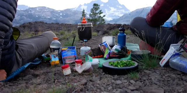
Proper Nutrition for Mountaineering
If you have ever suddenly felt weak, dizzy or drained of energy in the middle of a climb, the problem was most likely your nutrition. The mountains are not a place where your body can get by on minimal energy; every step, every slope and every metre of altitude requires the right fuel.
Eating well not only improves your performance, but also directly affects your safety, your decision-making and even how much you enjoy the climb. In this guide you will learn exactly what to eat, when to eat it and which mistakes to avoid.
Table of contents:
The best foods for mountaineering
Eating before a climb
Eating during the trip
10 good foods for mountaineering
Common nutrition mistakes
Conclusion
Frequently asked questions
The best foods for mountaineering
Choosing the right food for mountaineering means having enough energy without making your backpack too heavy. The best foods are usually light, energy-dense, long-lasting and easy to carry.
Good mountaineering foods are usually a combination of carbohydrates, healthy fats and a small amount of protein. Carbohydrates provide quick fuel for the body, fats give longer-lasting energy, and protein helps preserve muscle; as a result, your body gets instant energy and also tires more slowly.
The best options:
Nuts (almonds, walnuts, hazelnuts)
Dried fruit (raisins, dates, figs)
Dark chocolate
Whole-grain bread
Peanut butter
Energy bars
Plain, high-calorie biscuits
These foods are light, quick to eat, and provide the energy you need to keep going.
Eating before a climb
What you eat before you set off has a direct effect on how you perform along the route. Even so, many people don't take this seriously, and that causes an energy slump right at the start of the trail.
It is best to have a full, balanced meal 2 to 3 hours before the climb. This meal should include complex carbohydrates, a small amount of protein and a little fat; in other words, food that gives you energy without weighing you down.
Good examples:
Bread with honey or jam
Rice or potatoes
Eggs
Oats
Fresh fruit
Drinking water before you start climbing is also very important. Your body should be well hydrated from the very beginning.
Eating during the trip
While mountaineering, your body is constantly burning energy; so you should eat regularly and gradually, rather than waiting until you are completely hungry.
It is best to eat a small amount of food every 45 minutes to 1 hour. This helps keep your energy level steady and prevents sudden crashes.
Important tips:
Drink water continuously, in small sips
Choose light, easily digestible foods
Eat during short breaks, not when you are already completely exhausted
Good snacks to eat while climbing:
Dates and raisins
Chocolate
Nuts
Light sandwiches
Fruit
10 good foods for mountaineering
Whether your trip lasts one day or several, choosing the right food helps you keep your energy up and feel weak less often. Here are some practical options:
1. Granola
You can take granola or ready-made energy bars. It is best to choose a type sweetened with dried fruit, or make your own with oats and nuts to make it healthier.
2. Cooked quinoa
Quinoa is high in fiber and helps with digestion; as a result, you will feel lighter.
3. Fresh fruit and vegetables
They are a good choice for short trips and provide vitamins and water for your body.
4. Dried fruit
It keeps for a long time and is a good source of energy, fiber and minerals.
5. Hummus
Hummus is a healthy, energizing snack for mountaineering because it is high in calories, carbohydrates, fiber and protein. You can eat it with bread or crackers.
6. Nuts and whole grains
Macadamias, walnuts, Brazil nuts and almonds are high in calories and also contain protein, fiber, healthy fats, and important vitamins and minerals. Whole grains such as barley, quinoa and buckwheat are rich in fiber, complex carbohydrates, vitamins and minerals. Whole grains can be eaten at any time of day.
7. Nut butters
Nut butters such as peanut butter and almond butter are tasty and nutritious foods, as long as you choose natural products without added sugar. Nut butter is rich in calories, healthy fats and protein, all of which help you maintain your energy on the climb. You can also add them to all kinds of meals and snacks.
8. Tuna and vegetable salad
This dish is packed with protein and vegetables and is very easy to prepare and pack. Mix a can of tuna with some mayonnaise, finely chopped celery, sliced onion and some snow peas. Season with salt and pepper to taste, and add a little lemon juice if you like.
9. Beans and legumes
Beans are a rich source of protein, fiber and vitamins, and are well suited to long trips. Chickpeas, black beans and black-eyed peas can be added to any meal and eaten hot or cold. Legumes packed in foil pouches keep for a long time, which makes them an excellent choice for long journeys.
10. Dark chocolate
Dark chocolate containing about 70 percent cocoa is a wonderful antioxidant and an energizing food for hiking. Mix a few pieces of dark chocolate with nuts, seeds and dried fruit. Dark chocolate has a higher melting point than milk chocolate, because it contains a higher percentage of cocoa than milk fat.
Common Nutrition Mistakes in Mountaineering
Many problems in mountaineering are caused by simple nutrition mistakes, which are easy to prevent.
The most important ones are:
Skipping breakfast before the climb
Drinking too little water
Eating heavy, hard-to-digest foods
Leaving long gaps between meals
Eating too many simple sugars (which cause a sudden drop in energy)
Having no clear meal plan
Trying new foods during the trip (which risks digestive problems)
Another important point is paying attention to your body's needs at altitude. At high elevation, your body burns more energy, and this should be factored into your meal plan.
Conclusion
Nutrition in mountaineering is not something you can ignore. A large part of your energy, concentration and even your safety along the route depends on it.
By choosing the right foods, timing your meals well and avoiding common mistakes, you can perform better and enjoy your climb more. In the end, your body in the mountains responds to you exactly in proportion to how well you take care of it.
Frequently Asked Questions
1. Should we eat more carbohydrates or protein when climbing?
Carbohydrates are the main source of energy, but it is best to eat them together with a small amount of protein and fat.
2. Are energy drinks suitable?
In small amounts they may be useful, but they are not a substitute for water and proper nutrition.
3. How much water do you need when climbing?
It depends on the conditions of the route, but it is best to drink water regularly and before you feel thirsty.
4. What is the best light snack for the trail?
Nuts, dates, dark chocolate and dried fruit are among the best options.
5. Why are high-fat foods a good choice?
Fats provide longer-lasting energy than carbohydrates and are helpful on long trips.
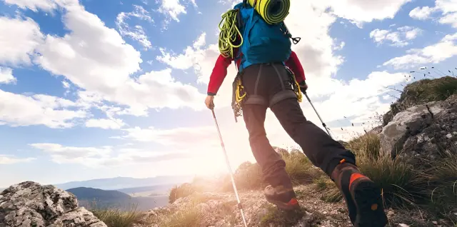
Common Mountaineering Mistakes: A Complete Guide to Prevention
Mountaineering is one of the most exciting nature activities, but if you do it without the right knowledge, it can very easily turn into a dangerous experience. The truth is that most mountain accidents are not caused by freak events but by common mountaineering mistakes, errors that even experienced climbers sometimes make. If you want a safe and professional climb, you need to recognize these mistakes and know how to avoid them.
Table of contents:
Beginners' mistakes in mountaineering
Common equipment mistakes
Dangerous mistakes on the route
How to avoid mistakes
Conclusion
Frequently asked questions
Beginners' mistakes in mountaineering
Many of the dangers of mountaineering start right here: when people head into the mountains without enough experience and assume the route will be easy.
One of the most important mistakes is not planning before the climb. Many people set off without checking the route, the departure time, the weather conditions and the difficulty level, even though a simple route can become truly challenging and dangerous in certain conditions.
Also, some people think mountaineering is just about getting to the destination, and they make no clear plan for the return, when the way back is just as important.
Underestimating your physical strength is another common mistake. Mountaineering requires physical fitness, and if your body is not ready, you will quickly suffer from fatigue, loss of concentration or even injury. The important point is that you must also keep in mind the strength needed to get back along the route you have covered, because many problems happen on the return.
In addition, some people go on a trip without telling anyone their route and return time. Before you set off, make sure someone knows your plan so that, if a problem occurs, follow-up is easier.
Other common mistakes include the following:
Starting late and being caught by darkness (that is, choosing a departure time that may leave you on the route after dark)
Having no fixed time to end the trip
Insisting on continuing in dangerous conditions
Climbing solo without enough experience (moving without a companion or guide)
Common equipment mistakes
Equipment plays a very important role in mountaineering, and choosing the wrong gear can make even a simple trip difficult for you.
One of the most common mistakes is wearing unsuitable clothing. Cotton clothes hold moisture and cause your body temperature to drop in cold weather. For this reason, a layered clothing system is recommended so that you can better control your body's condition.
Choosing unsuitable shoes is another major mistake. Ordinary city shoes or sneakers are not designed for mountain routes and may cause slipping, blisters or sprained ankles.
On the other hand, some people do not carry essential equipment, while others make their backpacks too heavy. The best approach is to find a balance: carry the essentials and avoid carrying unnecessary items.
Other important equipment mistakes:
Not having a headlamp (for emergencies)
Not having an extra warm layer
Not having a map or GPS
Not carrying enough water and food
Relying too heavily on your mobile phone
Dangerous mistakes on the route
Many of the dangers of mountaineering occur along the route, where wrong decisions can have serious consequences.
One of the most dangerous mistakes is leaving the main route. Many people leave the marked path to shorten the way, but this can get you lost or take you into dangerous areas.
Ignoring weather conditions is also a major mistake. Sudden weather changes are very common in the mountains, and disregarding them can put you in a difficult situation.
Poor time management is another important error. If you do not keep to a precise schedule, you may end up in darkness, cold or unsuitable conditions.
Other important mistakes on the route:
Trusting your phone and mobile signal too much
Ignoring warning signs and signboards
Continuing in fog, rain or poor visibility
Crossing slippery or dangerous sections without preparation
Ignoring fatigue and your body's signals
How can we avoid these mistakes?
To have a safe climb, you need to act knowledgeably and professionally.
The first step is careful planning. Before you set off, check the route, timing, weather conditions and your own ability, and make sure you share the details of your plan with a trusted person.
The second point is choosing suitable equipment. Layered clothing, proper shoes, enough water, energy-giving snacks and safety equipment should always be with you.
Another important point is knowing your personal limits. If you are tired or conditions are not right, continuing is not the right decision. Turning back in time is a sign of professionalism in mountaineering.
Finally, for a risk-free climb, always set a clear turnaround time, pay attention to the weather, stay on marked routes and listen to your body's signals.
Conclusion
Mountaineering is an enjoyable activity, but it can become dangerous if safety principles are ignored. Most of these dangers also come down to mistakes that can be prevented.
With proper planning, suitable equipment and informed decision-making on the route, you can avoid these mistakes to a great extent. Ultimately, the most important principle in mountaineering is to return safe and sound.
Frequently asked questions
1. What is the most important mistake in mountaineering?
Not planning and underestimating the conditions of the route.
2. Is mountaineering without equipment possible?
Perhaps on very easy routes, but in general it is very dangerous.
3. Why shouldn't you rely on your mobile phone?
Because in many mountain areas there is no signal, and the battery drains quickly.
4. When should you give up continuing on the route?
When the weather is bad, your body is exhausted or time has gotten out of control.
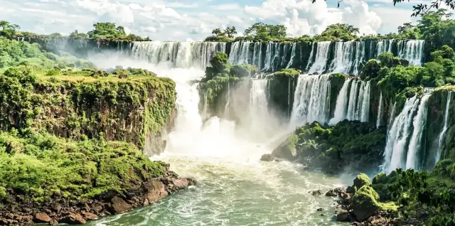
A Journey into the Heart of Nature: Discover the Most Beautiful Waterfalls in Iran
With its remarkable climatic and geographical diversity, Iran is home to a treasure trove of magnificent, enchanting waterfalls scattered across its many provinces. From the lush forests of Gilan and Mazandaran to the highlands of Lorestan and Fars, and even the mountainous areas of the west, you can find the soothing sound of falling water and breathtaking scenery in every corner. Below, we take a friendly and engaging tour of Iran's most beautiful waterfalls to help you get to know these natural gems better.
● Waterfalls of Gilan Province
Gilan Province is known for its ever-green landscapes, where the Hyrcanian forests, rushing rivers and dreamlike waterfalls give the region a magical character.
▪️ Laton Waterfall
The tallest waterfall in Gilan, it lies near Astara (Kuteh Kumeh village) and reaches a height of about 105 metres. The trail to the waterfall passes through dense forests of walnut, hazelnut, wild pear and other trees. A three- to four-hour walk through nature makes for an unforgettable experience for adventure lovers.
▪️ Visadar Waterfall
This waterfall is located near the town of Rezvanshahr (Parehsar). Visadar is about 15 metres high and sits along a scenic forest trail. Its semicircular rock formation and the cool air around it have made it a popular destination in spring and summer.
▪️ Dodozan Waterfall
Located in the Shaft area near Khoramkesh village, it is about 54 metres high. Relatively easy access, dense forests all around and the chance to swim in the lower pool have made Dodozan one of the most appealing hangouts in the hot season.
● Waterfalls of Mazandaran Province
With its mountainous, forested landscape, Mazandaran reaches the peak of its beauty in spring and summer. Countless small and large waterfalls in the province's dense forests and pristine pastures will captivate every visitor.
▪️ Safarud (Javaherdeh) Waterfall
Located near the Ramsar–Javaherdeh road, it is full of water and especially spectacular in spring. The access route passes through Safarud Forest Park, and the surrounding mountain views, cool air and short walking trail are the reasons for its popularity among travellers.
▪️ Shahandasht Waterfall
About 180 metres high, it lies in the Larijan area of Amol and is considered one of the tallest waterfalls in Mazandaran. Its multi-tiered structure and its proximity to the historic Malek Bahman Castle make a visit here both a historical and a natural experience.
▪️ Tirkan Seven Waterfalls
Located in the Lafur Forest of Babol. Seven small and large waterfalls are linked together in the heart of ancient Hyrcanian forests, creating a pristine setting. A forest walk of about three kilometres, cool pools and endless greenery promise moments full of peace and delight.
● Waterfalls of Golestan Province
Golestan, also famous for its Hyrcanian forests and attractive waterfalls, enjoys pleasant weather and lush scenery in spring and summer.
▪️ Shirabad Waterfall
A series of several cascading waterfalls in the lush forests near the town of Khan Bebin and Shirabad village. Clear, cool pools make this an excellent destination for summer recreation.
▪️ Kaboodval Waterfall
Located near Aliabad-e Katul, it is considered the only completely moss-covered waterfall in Iran. The soothing sound of water trickling through the green moss gives visitors an indescribable sense of freshness and coolness.
● Waterfalls of Western Iran and the Zagros
The Zagros Range in western Iran is home to some of the country's tallest and most beautiful waterfalls.
▪️ Bisheh Waterfall (Lorestan)
One of the most famous waterfalls in Lorestan, located near Dorud. At a height of nearly 48 metres amid oak forests, it offers an unparalleled view. The nearby railway line and good facilities make it easy to reach.
▪️ Ab-e Sefid Waterfall (Lorestan)
Located in the Aligudarz area, it has earned the nickname "the Bride of Iran's Waterfalls" for its white foam. The water emerges from a tunnel inside the mountain and plunges into the pool below with a dreamlike roar.
▪️ Shevi Waterfall (Khuzestan)
Located near Dezful, it is about 85 to 100 meters high and 40 to 70 meters wide, and is considered one of the largest waterfalls in the Middle East. The combination of the mountain setting, towering trees and the thunderous roar of the water creates an enchanting, adventurous atmosphere.
● Waterfalls of Central and Southern Iran
Central Iran has more spectacular waterfalls than you might imagine, and in the south, a land of deserts and heat, you may sometimes be surprised by small but stunning waterfalls.
▪️ Ganjnameh Waterfall (Hamadan)
It lies on the slopes of Alvand in Hamadan, where the historic Achaemenid inscriptions are also found. This blend of history and nature has made the waterfall one of the most popular destinations among domestic tourists.
▪️ Margoon Waterfall (Fars)
Located near Sepidan, it holds the title of the tallest spring-fed waterfall in the world. Thousands of bubbling springs gush from the rocks and pour down like a spectacular curtain of water.
▪️ Kamardoogh Waterfall (Kohgiluyeh and Boyer-Ahmad)
It is known as the "bride of the waterfalls of Kohgiluyeh and Boyer-Ahmad." It is full of water in every season, and its height has been reported to be as much as 100 meters. The surrounding mountain landscape offers visitors a setting full of silence and tranquility.
Final Tips and Summary
Iran's waterfalls, each with its own unique beauty and distinctive features, are hidden gems in the heart of the country's nature. The forests of the north, the mountains of the west and center, and even the southern and desert regions all have wonders of their own. Spring and summer are a good time to travel to these places, enjoy the coolness of the waterfalls, take photographs and escape the bustle of daily life with the soothing sound of falling water.If you love adventure, you can hike longer forest trails to reach lesser-known waterfalls. If you prefer easy access, waterfalls beside the road or near cities are a good choice. Some of these areas also have full amenities and are well suited to family picnics and camping. All you need to do is plan, pack the essentials and set off on an unforgettable trip; Iran is a land that is always happy to host you!

Introducing the Simorgh Mountaineering Project: A Complete Guide to Climbing Iran's 31 Highest Peaks
The national “Simorgh of Iran's Mountains” project is a development-oriented initiative in mountain tourism, run by the Mountaineering and Sport Climbing Federation of the Islamic Republic of Iran. Its main aim is to promote and climb the highest peak of each of the country's 31 provinces as sport-tourism attractions. The national project was launched in autumn 1395 (Solar Hijri) and officially opened to all active climbers in 1396.
To earn the Simorgh mountaineering badge, participants must climb the highest peak in each province of Iran (31 peaks in total). Besides promoting mountaineering as a sport, one of the project's key goals is to introduce climbers to the rich culture, local customs and sights of different regions of Iran. The Federation created the project as a national mountaineering-tourism scheme, inspired by similar international projects such as the 8,000ers club, the Snow Leopard award and the Seven Summits (the highest peak on each of the 7 continents).
Taking part in the Simorgh project requires following the rules set by the Federation. Under these rules, climbs must be carried out under the supervision of mountaineering clubs approved by the Federation, and to receive the Simorgh badge you must submit a report of the climb along with photos from the summit. In keeping with the importance of climbers' safety, the project pays particular attention to climbers' insurance, and solo or unofficial climbs are not permitted. Note also that, to keep climbers safe given the weather and the cold, winter climbs of 26 of the peaks are suspended from the start of Azar (late November); during this period only the four southern peaks of the country and Barfanbar Peak in Qom are open without restriction. So far the project has been very well received: more than 100 climbers have climbed all the peaks and received the Simorgh badge. This response reflects the project's popularity in Iran's mountaineering community.
List of the Simorgh Project Peaks
The Simorgh project involves climbing 31 high peaks in the 31 provinces of Iran. The list below gives these peaks along with their province and approximate height. Note that heights reported in different sources may differ slightly.
List of the Simorgh Project Peaks
Sabalan in Ardabil Province, approximate height 4811-4818
Shahan Kuh in Isfahan Province, approximate height 4040-4044
Kan Seyfi in Ilam Province, approximate height 2910-3050
Kamal (Quchgoli) in East Azerbaijan Province, approximate height 3707-3767
Orin in West Azerbaijan Province, approximate height 3651-3702
Shah Alborz in Alborz Province, approximate height 4150-4170
Birmi in Bushehr Province, approximate height 1950-1970
Khalenow in Tehran Province, approximate height 4350-4390
Kolonchin in Chaharmahal and Bakhtiari Province, approximate height 4221-4250
Nayband in South Khorasan Province, approximate height 2853-3005
Shirbad in Razavi Khorasan Province, approximate height 3303-3327
Shahjahan in North Khorasan Province, approximate height 3032-3081
Kino in Khuzestan Province, approximate height 3700-3761
Belqeys in Zanjan Province, approximate height 3332-3363
Shahvar in Semnan Province, approximate height 3905-3910
Taftan in Sistan and Baluchestan Province, approximate height 3911-3941
Bol in Fars Province, approximate height 3943-3953
Syalan in Qazvin Province, approximate height 4197-4250
Barfanbar in Qom Province, approximate height 3233-3260
Quli Zoleykha in Kurdistan Province, approximate height 3195-3250
Hezar in Kerman Province, approximate height 4500-4501
Parav in Kermanshah Province, approximate height 3390-3405
Qash Mastan in Kohgiluyeh and Boyer-Ahmad Province, approximate height 4436-4450
Gavkoshan in Golestan Province, approximate height 3800-3841
Samamus in Gilan Province, approximate height 3050-3716
Sanbaran in Lorestan Province, approximate height 4100-4150
Damavand in Mazandaran Province, approximate height 5609-5610
Domir in Markazi Province, approximate height 3400-3505
Tashgar in Hormozgan Province, approximate height 2340-3327
Kubari (Glacier) in Hamadan Province, approximate height 3586
Shirkuh in Yazd Province, approximate height 4075
Detailed Introduction to the Simorgh Project Peaks
• Mount Damavand
Mount Damavand, at 5609 meters above sea level, lies in Mazandaran Province, in Amol County. It is the highest peak in Iran and in West Asia, and is also considered a dormant (semi-active) volcano, standing in the center of the Central Alborz range, south of the Caspian Sea. Thanks to its special place in Iranian mythology and folklore, Damavand has great cultural importance. In clear weather this majestic peak can be seen from Tehran, Varamin and Qom, as well as from the southern shores of the Caspian Sea.
The soil of Damavand consists mainly of volcanic ash, and the vegetation varies with altitude. Below 2000 meters, especially on the northern slopes, there are forests of cypress, pine, oak, boxwood and silk tree (Albizia). Between 2000 and 3000 meters, pastures and meadows spread out, and at 3000 meters and below, wild poppies grow, said to have medicinal properties. Between 3000 and 4000 meters you can see several kinds of astragalus (milkvetch), thorny plants and seasonal flowers. Above 4200 meters, the area has no vegetation at all. Native and medicinal plants of the region include Damavand yarrow, Damavand groundsel, clover dodder and thyme dodder, kazal, ram's beard, forget-me-not, bellflower, Damavand iris, mound sainfoin, rock gypsophila and Kolah-Mir Hasan.
In terms of wildlife, Mount Damavand is home to a wide variety of animals. Foxes, jackals, dogs and wolves can be seen around the mountain, and these species live even at altitudes of 4,000 meters. Bears have also been sighted in the northern and western parts of the mountain. In addition, herbivores such as gazelles, hares, wild sheep and wild boar live in the area. The sky above Damavand is home to birds of prey such as the golden eagle, owls and bats, and partridges, parrots and woodpeckers are other bird species found on this mountain. In recent years, sightings of leopards have also been reported in the Kuh-e Sefid area of Damavand.
Livestock farming is also common on the slopes of Mount Damavand and the surrounding areas. In Damavand County, various pets and livestock are bought and sold, including Qawqaz dogs, Husky dogs, peacocks, local roosters, pigeons, budgies and camels. In addition, the Khorshid tourist farm in Damavand raises a variety of domestic animals, giving visitors a chance to get to know them.
Climbing Damavand involves a number of hazards, the most important of which are altitude sickness, reduced oxygen levels, cold and unpredictable weather conditions. The steep gradient of the route in some places, the possibility of rockfall and getting lost are other potential dangers. Strong winds, storms and lightning can also make the climb difficult. Hypothermia and frostbite are serious dangers if climbers are not well prepared and properly equipped. In busy seasons, traffic on the climbing route can also cause problems. The number of injuries and deaths on the Damavand climbing routes is worrying and shows the need for full physical fitness, experience of climbing at high altitude, and suitable equipment. Reserving a place in the mountain hut and obtaining a climbing permit from the Mountaineering Federation are also essential safety requirements for climbing this peak.
There are 16 different routes to the summit of Damavand, of which 4 routes (south, west, north and northeast) are recognized as the main routes. The south route, which starts from the villages of Polur and Reyneh, is the most common and generally the easiest climbing route, and has the Bargah-e Sevom hut. The west route starts from the city of Abadi and reaches the Simorgh hut at an altitude of 4,200 meters. The north route passes between the Siyoleh and Dobisel glaciers and has two emergency shelters at altitudes of 4,000 and 5,650 meters. The northeast route starts from the village of Gazanak and, following a long ridge, reaches the Takht-e Fereydun hut at an altitude of 4,300 meters; another route starts from the village of Haji Abad and the Ehsani sheepfold, and is shorter. In addition to these main routes, there are other secondary routes to the summit of Damavand, including the southeast, the south-northwest and the Yal-e Dagh ridge. To reach the starting points of the south and west routes, you can travel along the Haraz Road to the Polur and Reyneh areas, and the route through the village of Nandel is suitable for reaching the north routes. The huts on the main routes are Bargah-e Sevom on the south route, Simorgh on the west route, the 5000 shelter on the north route, and Takht-e Fereydun on the northeast route.
Access to water varies along the Damavand climbing routes. On the south route, there is a spring at the Bargah-e Sevom hut. On the north route, the last water source is the sheepfold, about three kilometers before Sang-e Bozorg (the Big Rock); it may also be possible to collect water above the 5000 shelter and from the glacier. The northeast route offers access to water only at the sheepfold. On the west route, the glacier spring to the right of the Simorgh hut flows in all seasons. On the southeast and south-northwest routes, there is no spring along the way.
• Sabalan Peak
Sabalan Peak, at 4,811 meters above sea level, is located in Ardabil Province near the city of Meshgin Shahr. It is the third highest peak in Iran and a dormant volcano with a beautiful lake at its summit. Sabalan attracts tourists for the natural hot springs on its slopes, its beautiful summer scenery and the famous Alvares ski resort.
The slopes of Sabalan have diverse vegetation, with more than 3,000 plant species. The natural pastures of this region are very rich, and plants such as barberry, garlic, carnation, wild rose, madder, borage, anemone, iris and tulip grow there. Hyacinth, basil, pennyroyal and milkvetch are other native plants of the area, which contribute to the production of high-quality honey. Mount Sabalan is home to a variety of wild animals, including brown bears, weasels, foxes, jackals, hares, sparrowhawks, owls, hoopoes, larks, swallows, martins, crows, golden eagles and wild boar. Wild goats, ibex and Armenian mouflon are also found in this region.
Thanks to its rich pastures, the slopes of Sabalan are well suited to livestock farming, and beekeeping also thrives in the region, producing high-quality honey. Although detailed information about domestic animals around the summit is not available, mentions of sheep and goats in climbing reports suggest that livestock farming exists in the area. There is also a pet shop called Sabalan in Tehran, which may be named after this region.
Climbing Sabalan Peak may involve hazards such as altitude sickness, cold, wind and the possibility of fog. The steep gradient on some routes, the presence of precipices and the similarity of the routes to one another are also things climbers need to pay attention to. Physical fitness and sufficient experience, attention to the guide flags, and caution against the danger of icing in winter are important safety tips for climbing this peak.
There are three main routes to the summit of Sabalan. The northeast route is the most common; it starts from the Shabil hot spring and reaches the summit after passing the hut. The west route starts at the foot of Lake Qareh Gol and, after passing Harameh Chal and the Harameh glacier, reaches the west shelter and then the summit. The south route starts from the south side of the peak and, near the summit, leads to it via the east ridge; the Alvares ski resort is also located on this route. To reach the northeast route, you can travel via Ardabil to Meshgin Shahr and Lahrud, and the Ardabil–Meshgin Shahr road also provides access to Shabil. The Alvares ski resort is located on the south route.
On the northeast route, the Shabil hot spring is at the start, and there is a spring near the shelter. On the west route, Lake Gharehgol is at the start. The south route has no shelter or water source along the way. Hot springs such as Shabil and Ghinarcheh are also found on the slopes of Sabalan.
• Hezar Peak
Hezar Peak, at 4,501 meters above sea level, is located in Kerman Province, south of the Rayen district. It is known as the highest peak in southern Iran and the central plateau, and it is said to have been given its name ("Hezar" means "thousand") because of the great diversity of its vegetation. Hezar is the source of the Yatehrud River, and near it stands a shrine resembling the shrines of the goddess Anahita. The slopes of the peak welcome climbers and nature lovers in spring and summer, and a stone shelter stands at an altitude of 3,100 meters. The highest inhabited place in Iran, the village of Bab Zangi at 3,309 meters, is also located on Mount Hezar.
Mount Hezar has very diverse vegetation, with more than a thousand different plant species. Native plants of the area include anemone, thyme, yarrow, mofarrah, wild marjoram, wild celery, pennyroyal, ezgen, asafoetida, wormwood, astragalus, mushrooms, rhubarb, kal, wild lettuce, wild spring onion, koma, garchik and shurkuh wood. The wildlife of the area includes wolves, wild boar, ibex and wild goats, hares, foxes, chukar partridges, see-see partridges and squirrels. The pastures on the slopes of Mount Hezar are used by nomads for grazing livestock, and the high-altitude village of Bab Zangi shows the presence of animal husbandry in the area.
Climbing Hezar Peak is considered a demanding, technical ascent with a difficult grade. At times, because of the spread of COVID-19, a ban on climbing this peak has been announced. The climb requires a high level of physical fitness and, on some routes, rock-climbing skills and a local guide. Altitude sickness is also possible at this elevation.
There are various routes to the summit of Hezar. The north route runs from the village of Zarrud via the Rayen Waterfall to the Hezar shelter and is the most common route. The south route starts from the Ardekan area. The Bab Zangi route is the shortest route to the summit. The Mirshadi Valley route is another way up the peak. To reach the start of the climb, you can travel from Kerman to Rayen and then take the Rayen Waterfall road. The village of Ardekan is located southwest of the peak.
On the north route up Hezar, there is a spring near the shelter. The south route is short of water, and no information about water access is available for the Ardekan route. The Bab Zangi route is also known as a low-water route.
• Qash Mastan Peak
Qash Mastan Peak, at 4,450 meters above sea level, is the highest peak of Kohgiluyeh and Boyer-Ahmad Province and of the Dena range, as well as the highest peak of the great Zagros range. It is known as the roof of Kohgiluyeh and Boyer-Ahmad Province and is on the list of peaks of the Simorgh Plan. The Dena range has a ridge roughly 90 kilometers long and lies between the three provinces of Kohgiluyeh and Boyer-Ahmad, Isfahan and Fars. The town of Sisakht, the center of Dena County, lies on the slopes of this mountain. The name Qash Mastan derives from a famous legend in Ferdowsi's Shahnameh and from the rich culture of the Turkic nomads.
The Dena range has diverse vegetation. At lower altitudes, dense oak forests can be seen, and other important plant species include wild pistachio, mountain almond, terebinth, hawthorn and astragalus. At higher altitudes, especially along the routes to Qash Mastan Peak, plants such as astragalus, zarrin giyah, bilhar and wild mountain mint also grow.
Animal diversity in the Dena range is very high and includes large brown bears, see-see partridges, eagles, vultures, lammergeiers, leopards, wolves, wild cats (especially caracals), martens, weasels, Persian squirrels, falcons, saker falcons, chukar partridges, stone curlews, rock partridges and larks (various types of pouch-mouthed birds), as well as ibex and wild goats among the many species of Dena. Ibex and wild goats have been reported during climbs of Qash Mastan Peak. No precise information is available about domestic animals around the peak, but given the villages and nomads in the Dena area, livestock herding is likely in these regions.
Because of its great height and the presence of glaciers, climbing Qash Mastan is considered one of the heavy and challenging ascents in Iran, with a difficult grade. In winter, the risk of avalanches and rockfall is very high, and crossing the glaciers requires caution and suitable equipment.
The most common and easiest route up Qash Mastan starts from the village of Khafr in Padena. From the village, two routes lead to the shelter: the left-hand route past the Kuh-Dezh, which is shorter, and the right-hand route, which passes beside a waterfall and is longer but more pleasant. The south route over the Bonroo Pass, right below Qash Mastan Peak, also makes the climb possible, though it requires rope protection at the end. The west route can also be climbed from the village of Sisakht across the central ridge of Dena. To reach the village of Khafr, you need to travel from Semirom toward Yasuj.
On the route up Qash Mastan from the village of Khafr, there are several springs and patches of snowmelt along the way. For the other routes, no precise information about water access is available. Midway along the climb from Khafr, the Qash Mastan shelter stands at an altitude of about 3,000 meters, which is a suitable place to set up camp.
• Khalano Peak
Khalano Peak, at 4,350 to 4,390 meters above sea level, is the highest peak of Tehran Province and the third highest peak in the Central Alborz after Damavand and Alam-Kuh. The peak is bordered to the south by Shemshak and the Roudbar-e Qasran valley, to the north by the valley of the Varangrud River, to the east by the Lar Plain (the Lavasanat area), and to the west it connects via the Harzehkuh ridge to the Karaj River valley. Khalano is the main source of the Varangrud River, which is the main feed of the Karaj Dam Lake.
The vegetation of Khalenow Peak includes astragalus (gavan), golpar (hogweed), tulips, poppies, barberry, wild garlic (sir), lochak and nettle, all found in this area. In terms of wildlife, birds such as the golden eagle, the imperial eagle (homa), chukar partridge, see-see partridge, lark and hoopoe, and animals such as wild boar, wild rams and ewes, ibex and wild goat, brown bear and wolf live in this region. No precise information is available about domestic animals on the heights of Khalenow, but given the villages of Lalun and Shemshak near the peak, livestock herding is likely in these areas.
Overall, Khalenow is a technical, high peak in the Central Alborz, and climbing it requires mountaineering experience and a high level of physical fitness. Crossing the ridges at an altitude of 4,300 meters adds to the relative difficulty of this climb. Climbing Khalenow alone is not recommended, and carrying navigation equipment and knowing the route well are essential.
The most common route up Khalenow Peak starts from a gorge north of Lalun village (in Rudbar-e Qasran rural district). After passing the Talkhab Spring and Khalenow Waterfall, it reaches the Vazuab Pass and the Khalenow Cirque (Kaseh-ye Khalenow), and finally the summit. Other climbing routes include the Varangeh-rud Valley, Abnik village and Shemshak village (the winter route).
On the route from Lalun village, there is the Talkhab Spring (not drinkable) and a fresh, pleasant spring after the waterfall and before the pass. On the Varangeh-rud Valley route, water is available at Do Ab and Khalenow Lake.
• Kolunchin Peak
Kolunchin Peak, at 4,221 to 4,250 meters above sea level, is the highest peak of the Zardkuh Bakhtiari range and the roof of Chaharmahal and Bakhtiari Province. After Dena Peak, it is the second-highest mountain in the Zagros range. The Zardkuh Bakhtiari range lies between the two large rivers Kuhrang and Bazoft. In the local dialect, Kolunchin means "stone-piler" (sangchin), and the name comes from the type of rock of this peak and the other peaks along the climbing route.
The vegetation of Kolunchin Peak includes plants such as astragalus (gavan), zarrin-giah, bilhar and wild mint. Dense oak forests are also seen in this area. The wildlife of this region includes brown bear, leopard, ibex and wild goat, wild ram and ewe, see-see partridge, goshawk, peregrine falcon, golden eagle, horned viper, Mediterranean tortoise and ferruginous duck. No precise information is available about domestic animals on the heights of Kolunchin, but given the presence of nomads in the Zardkuh region, livestock herding is likely in these areas.
Because of its great height and the glaciers, climbing Kolunchin Peak is considered one of the heavy and challenging climbs in Iran, and its difficulty grade is hard. In this month of the year (Mordad), you must move carefully across the glaciers and beware of the edges, melting collapsing layers and the thin ice of the glaciers.
The common route up Kolunchin Peak passes through the East Valley, the second tunnel of the Kuhrang Dam and the Kul-e Khadang Gorge, and has no shelter. The winter route is possible via the east ridge and the Khersan hut. Other climbing routes include the north ridge (the first dam of the Kuhrang Tunnel and the Chal-e Mishan hut) and the east ridge (Khersan hut). To reach the starting point of the East Valley route, you must first go to Polur on the Haraz Road, then head toward the second tunnel of the Kuhrang Dam via the Federation base camp.
Because of the glacier, most springs along the route up Kolunchin Peak are blocked and there is no drinking water. A limited amount of snowmelt may be found at the start of the valley. Near the campsite there is also a spring called "Mar Bori", whose water is clear and cold. The Chal-e Mishan and Khersan huts are located on the eastern slope of the peak, and there is water next to the Chal-e Mishan hut.
• Sialan Peak
Sialan Peak, at 4,175 meters above sea level, lies on the border of Mazandaran and Qazvin provinces in the Alborz range. To the north, the peak overlooks the Do Hezar Valley and the Daryasar Plain in Tonekabon County, and to the south it overlooks the Rudbar section of Eastern Alamut in Qazvin Province. In the local dialect, the name Sialan means "three ridges", because the peak stands where three ridgelines meet.
The vegetation of Sialan Peak includes pine trees known as ores (juniper), mountain cypress, marshmallow flowers, mountain tea, valak and golpar (hogweed), which cover this region. In terms of wildlife, the area is a habitat for eagles, hares, chukar partridges, lizards, ibex and wild goats, and other wild mammals. No precise information is available about domestic animals on the heights of Sialan, but given the villages of Heniz and Asal Mahalleh near the peak, livestock herding is likely in these areas.
The access routes to Sialan are long, and climbing it requires good physical fitness. A winter ascent of Sialan Peak can be dangerous because of the cold, heavy precipitation and strong winds, and requires specialized equipment.
Sialan Peak can be climbed by three main routes: the southern route from Heniz village in Qazvin Province, which has a gentler slope and is more suitable for beginner climbers; the northern route from Asal Mahalleh village in Mazandaran Province, which is more complex and longer and passes beside the Daryasar Plain; and the ridge route, which passes the huts at the Kandigan Pass and is suitable for advanced climbers.
On the southern route up Sialan Peak from Heniz village, there are several springs, including the Gol-e Pari Spring. On the northern route from Asal Mahalleh village, the Gurkhani Spring is located. The Rahnama Ghobadi Sialan hut stands at an altitude of 3,260 meters on the southern route, and the Yadbud hut is located on the northern route before Daryasar.
• Shah Alborz Peak
Shah Alborz Peak, at 4,150 to 4,175 metres above sea level, is the highest peak in Alborz Province and forms the natural border between Alborz and Qazvin provinces. Its southern slopes overlook the Taleqan Valley in Alborz Province, and its northern slopes overlook the Alamut Valley in Qazvin Province. The peak is also called Taleqan Peak. To the west, Shah Alborz connects to Zivarchal Peak, and its northern side is bounded by walls and high rock faces about 600 metres tall and by permanent glaciers.
The vegetation of Shah Alborz includes apple, walnut, cherry, pear, wild barberry, hawthorn, plane and willow trees, as well as medicinal and ornamental herbs such as rhubarb, wild leek and chicory. The area's wildlife includes hares, hyenas, wild boars, jackals, wolves and bears, and among the birds you can find eagles, wagtails, choughs, falcons and partridges. There is no precise information on livestock in the Shah Alborz highlands, but given the villages of Hasanjoon and Heranj on the southern slope and Garmarud and Dinehrud on the northern slope, livestock herding is likely in these areas.
The climb to Shah Alborz Peak is one of the longest routes among the peaks of the Central Alborz, covering about 17.5 kilometres to the summit. The route has no huts or shelters. In spring, because of the snow on the slopes, observing safety precautions is essential, and if you climb from Hasanjoon village, you first pass through lush green trees. A winter ascent of Shah Alborz requires previous experience and heavy winter mountaineering equipment.
The common route up Shah Alborz starts on the southern face, from Hasanjoon village in Taleqan, and follows the river and a sheepfold. The northern routes can also be climbed, from Garmarud village in Alamut (the northwest ridge) and Dinehrud village in Alamut (the northeast ridge), and another route runs from Heranj village in Taleqan and Si Cheshmeh.
On the route from Hasanjoon village there are several springs along the way. The Olang spring is the last drinkable spring, located at an altitude of 3,376 metres, about two hours from the summit.
• Sanbaran Peak
Sanbaran Peak, at 4,100 to 4,150 metres above sea level, is the highest peak of the Oshtorankuh range in Lorestan Province and of the third-highest range in the Zagros, after Dena and Zardkuh. The peak overlooks Gahar Lake and lies to the south of it. To its east is the village of Darreh Takht, and to its north is the village of Tayan. The word Sanbaran is made up of two parts: "Sanb", meaning a horn or something horn-like, and "Ran", meaning a part or region. It probably means "the horn of the region", a name given because of the peak's height.
The vegetation of Oshtorankuh and Sanbaran Peak includes abundant wild pistachio, milk-vetch, rhubarb, steppe vegetation on the gentle slopes, wild flowers, barberry, garlic, carnation, rose, madder and borage.
This region is home to a variety of animal species, including brown bears, foxes, hyenas, wild boars, grey wolves, wild goats and wild rams, and among the birds you can find eagles, partridges, owls, ducks and falcons, all of which are under environmental protection. The slopes of Oshtorankuh have long been home to some Lur tribes, and its pastures are used by the nomads of this area.
Climbing Sanbaran is one of the country's notable ascents, and Himalayan expedition teams do their final domestic training on the peaks of Oshtorankuh. The route up Sanbaran has a very steep section known as the "Fish Back" (Gerdeh Mahi), which requires strong muscles. Climbing in autumn and winter is very hard and exhausting because of the cold, precipitation and strong winds, and demands great strength and proper mountaineering equipment.
The most common route up Sanbaran starts on the northern side from Tayan village and reaches the summit after passing the Gol Gol Hut and the Chal Kabud Hut. The northern route passes through Tayan village, the Gol Gol Hut, the Chal Kabud Hut and Sanbaran Peak. Another route can be climbed from Bidestaneh village via the northern face of the peak, which involves about 2 kilometres less walking. Sanbaran Peak is accessible via the main Isfahan–Lorestan highway (Azna County), as well as via the town of Azna or the Tehran–Ahvaz railway (Azna County station).
On the route up Sanbaran from Tayan village, the Gol Gol spring is next to the first hut. Between the Gol Gol Hut and the Chal Kabud Hut there is no other water source, so you must carry enough water. A spring has also been reported at an altitude of 3,500 metres, before the Varzab Pass, on the route through the Lalun Valley to Khalano Peak, which may also be related to Oshtorankuh.
• Belqeis Peak
Belqeis Peak, at 3,332 to 3,363 metres above sea level, is in Zanjan Province, eight kilometres northeast of Takht-e Soleyman. The peak lies at the end of the Balkash mountain chain, east of Lake Urmia, and is the highest peak of the Qarakh Bolagh (Chehel Cheshmeh) mountains. On the southern summit are the remains of the stone fortress of Takht-e Belqeis, which was used in Sassanid times as a watchtower for Takht-e Soleyman. Between the two summits there is a very beautiful lake, formed by melting snow, that is visible for most months of the year.
The slopes of Belqeis are home to rare edible and medicinal wild plants, including rhubarb, nettle, thyme, lavender, kashmak, savory, sorrel, bulagh uti, liquorice and marjoram. The wild animals of this area include bears, jackals, wild boars, wolves, foxes and hares, and, more importantly, a dangerous venomous snake known as the «Belqeis viper», about twenty to fifty centimetres long, brown and dark green and the same colour as the rocks of the area, has been seen around this mountain. There is no precise information on livestock in the Belqeis highlands, but given the villages of Dandi and Qaravolkhaneh near the peak, livestock herding is likely in these areas.
There are two main routes up Belqeis Peak. The southern route starts from Dandi and Qaravolkhaneh village; it is shorter than the Takht-e Soleyman route and is the most common route. The southwest route also starts from Dandi and reaches Takht-e Soleyman via the mine road. The northeast route is possible from West Azerbaijan Province, Takab County and the mine road.
On the southern route up Belqeis Peak (from the Qaravolkhaneh ranger station), there are about 5 seasonal springs along the river, so water shortage is not a problem on the route. On the chosen route, there is also a permanent spring about an hour below the summit, a good place to rest.
• Tashgar Peak
Tashgar Peak, at 3,267 meters above sea level, is the highest peak in Hormozgan Province. It lies in the Homag Mountains and is a popular destination for professional climbers and nature lovers. The peak is located 60 kilometers north of Bandar Abbas County and in the southern part of Hajiabad County. Mount Homag is the highest part of Hormozgan Province, belonging to the southern Zagros range and forming part of the Zagros Fold Belt. According to local people, the name Tashgar comes from the burning of a juniper (Ars) tree, which was struck by lightning, caught fire and burned.
At the middle elevations of Mount Homag and Tashgar Peak, the dominant plants of the area are wild almond, bitter almond (badamak), wild pistachio (baneh), Qeich, ebony and milkvetch (gavan), while juniper and wild olive dominate at higher elevations. A variety of fruits, including tangerines, grapes, walnuts, dates, figs and apricots, also grow in the orchards of the area. The dominant birds of the area are chukar partridges and see-see partridges, which are found in abundance in all seasons of the year. Various birds of prey, owls and other birds such as bee-eaters, kites, green bee-eaters, black francolins, warblers, wagtails and chaffinches also live in this area. No precise information is available on domestic animals in the Tashgar highlands, but given the villages of Totang and Zakin on the southern slope, livestock herding is likely in these areas.
The best seasons for climbing Tashgar Peak are autumn and winter, and the trip is usually 2 days. Climbing Tashgar Peak has no particular technical difficulty and is suitable for experienced climbers as well as beginners. The route is challenging mainly because of its altitude and length, and it requires a good level of physical fitness.
Tashgar Peak can be climbed by several different routes. The northern route (Homag) reaches the summit from the north of Mount Homag and, because of its length and difficulty, is better suited to professional climbers. The southern routes start from the villages of Totang and Zakin. Among these, the route from Zakin village is known as the standard route to the summit of Tashgar. To reach Zakin village, you can take the road Hajiabad – Siahu village – Dargaz village – Zakin village.
On the route up Tashgar Peak from Zakin village, there is a drinkable spring at an elevation of 1,666 meters (Zakin Spring), the non-drinkable Parzardu Spring at 2,162 meters, and the non-drinkable Chah-e Malek Spring at 2,594 meters. At 2,500 meters, there is a place to spend the night, with huts built from stones and date palm leaves.
• Barfanbar Peak
Barfanbar Peak, at 3,200 to 3,260 meters above sea level, is considered the highest peak in Qom Province. It is located 60 kilometers south of the city of Qom, in the orchards south of Fordo village in Kahak District. The peak is named for the 600-meter-deep valley beside it, where a large amount of snow accumulates in winter, and this snow sometimes lasts until the summer of the following year.
The vegetation of the mountainous areas of Qom is rich, and wild almond, medlar and wild pistachio shrubs are characteristic plants of these areas. As for wildlife, jackals, wolves, foxes, hares, chukar partridges, see-see partridges, steppe eagles, kestrels, falcons, vultures and various kinds of sparrows can be seen in these areas. At the foot of Barfanbar there are two cold springs that flow from inside the mountain and from the three snow-filled pits of Barfanbar, and lead to the dense orchards of Fordo.
Because of its low altitude and the absence of scrambling on the route, climbing Barfanbar Peak is one of the easiest ascents among Iran's well-known peaks, and its difficulty is low to moderate. However, weather conditions and the season can make the climb harder.
The most common route up Barfanbar Peak starts from Fordo village. Other routes include the Vasaf Valley route, the Karmjegan village route and the Jasb area route. To reach Fordo village, take the old Qom–Kashan road from the city of Qom, then go to the city of Kahak and from there to Fordo village.
At the start of the route from Fordo village, there is the Abidar Spring beside a sheepfold, which has plenty of water. There are also two cold springs at the foot of Barfanbar. The Barfanbar mountain hut appears after the summit, and it is not possible to enter it if there is a crowd of climbers. On the route up from Vasaf Valley, it may also be possible to find water at an elevation of 3,100 meters (on the side route of the ascent).
• Quli Zoleikha Peak
Quli Zoleikha Peak, at 3,195 to 3,250 meters above sea level, is the highest peak in Kurdistan Province and one of the highest peaks of the Zagros range in northwestern Iran. The peak is located in the Chehel Cheshmeh area, on the border between Divandarreh and Saqqez counties. The Chehel Cheshmeh mountains are among the snowiest and coldest areas of Kurdistan, are covered with snow throughout the year, and are counted among the largest natural glaciers in Iran. Zoleikha Peak is known as the roof of Kurdistan Province and is on the list of peaks of the Simorgh Plan.
The vegetation of Quli Zoleikha Peak and the Chehel Cheshmeh mountains includes solan or primrose, kashmeh, loosheh, pesal or kul, samoor, rhubarb, mani, soore baneh, gooni, kanival, ivy, barza, senobar, qeitaran, violet and salmeh. The wild animals of this area include bears, wolves, foxes, hares, rock partridges, many snakes and wild boars. Tracks of these animals, including bears, have been seen in the snow. No precise information is available on domestic animals in the Quli Zoleikha highlands, but given the village of Bast near the peak, livestock herding is likely in these areas.
The area around Zolaykha Peak is known as one of the snowiest and coldest regions of Kurdistan. Climbing it in winter is very dangerous because of its steep routes and avalanche-prone valleys, and requires full attention to all safety considerations. The ascent of Zolaykha Peak is of moderate difficulty and suits climbers with intermediate experience, but it requires good physical fitness. Finding the correct route among the many rocky ridges requires experience and an experienced local guide.
The best and most common route up Zolaykha Peak starts from Bast village in Divandarreh and follows the northeast face. A longer route leads from Bast village to Shah Neshin Peak and then follows the ridge to Qowli Zolaykha Peak. Another standard route goes from Bast village to the summit via the Chalcheme spring. Bast means "dead end", and the village is the last settlement in this mountainous area. There is a suitable mountaineering base at the end of the village where climbing teams can stay.
There are many springs on all sides of the Qowli Zolaykha area. The most famous and best-flowing of them is called Kani Chaworesh and lies on its southeast flank. Water is easy to find along the climbing route.
• Shah Jahan Peak
Shah Jahan Peak, at 3032 to 3081 metres above sea level, is the highest point of the Aladagh range in North Khorasan Province and is known as the "Roof of North Khorasan". The peak lies at the meeting point of the three counties of Shirvan, Faruj and Esfarayen. The name "Shah Jahan" is linked to a historical and religious story, and some sources attribute it to the tomb of a prominent lady called "Shah Jahan".
The vegetation of Shah Jahan includes juniper trees, mountain barberry, chicory, pennyroyal mint, ankh, aghbash, lavender (Stoechas), various types of wormwood, astragalus, siah-talu, several kinds of wild tulips, wide pastures and hundreds of other unidentified species. Precise information about the wildlife of Shah Jahan is not available, but since the peak lies in the mountainous Aladagh region, animals such as foxes, jackals, wolves, chukar partridges and see-see partridges are likely to live there. The pastures on the slopes of Shahvar, close to Shah Jahan, are the grazing area of the villages of Abarsaj and Nekarman, and livestock farming probably takes place on the slopes of Shah Jahan as well.
Climbing Shah Jahan Peak usually takes about 4 to 6 hours and is rated as moderately difficult. The route from Tash village has a relatively gentler gradient, while the Jangal-e Abr route is longer and more challenging. At high altitudes, snowfall and wind are possible. In recent years there have been reports of climbers getting lost on Shah Jahan because of snow and blizzards, which shows the need for caution and preparation when climbing this peak.
The most common route to Shah Jahan Peak starts from the south face and the village of Nodeh Bam in Esfarayen County and takes about 4 hours. Other routes include the Tash village route (the most commonly used), the Khargh village route (the safest and shortest), the Amiranlu village route (north) and the Khosroyeh village route (northeast).
On the route up Shah Jahan Peak from Tash village there are natural springs, among them the Haft-Rang ("Seven Colours") spring, with clear, pleasant-tasting blue water. On the Nodeh Bam route there is also a cold, pleasant spring below the summit on the south side, whose water flows down to the villages below.
• Naybandan Peak
Nayband Peak, at 3005 metres above sea level, is the highest peak in South Khorasan Province. It lies in the Dihuk area of Tabas County and is known as the roof of South Khorasan. The peak is part of Iran's national Simorgh mountaineering programme and, thanks to its natural and environmental importance, is considered one of the most outstanding climbing destinations in Iran. Nayband village, on the edge of the Lut Desert, is the main base for climbing Nayband Peak. Because of its geographical position and distinctive climate, the area is known as one of the most important wildlife refuges in Iran. The name "Nayband" was given to it because of the natural gorges in the area and because it links two parts of the desert.
The vegetation of the Nayband area includes plants such as wild almond (arzhan), ivory almond, saxaul (taghe), wild fig, astragalus and cumin. The area is particularly important for endangered species such as the Asiatic cheetah and is home to varied animals such as wild rams and ewes, caracals, red foxes, sand foxes, jackals, Indian crested porcupines, tashi and desert hares, as well as various snakes. Nayband village has an example of stepped architecture and has earned the title "Masuleh of the Desert". Life in the village has continued for years thanks to the water of its qanats.
Nayband Peak is a relatively difficult but technical peak in the desert region of South Khorasan. Climbing it requires good physical fitness and experience of mountaineering in desert areas. Climbing it without a guide and without a permit from the Tabas County Mountaineering Board can be dangerous, especially because there are no shelters or water sources along the route. The rocky, crumbling terrain of the Nayband mountain and the large temperature difference between day and night are further challenges of climbing this peak.
The only way up Nayband Peak is from the north face, and the starting point is a spot at the end of the dirt road in the Naybandan Wildlife Refuge. To climb the peak, you must go from Nayband village towards the abandoned village of Aliabad and then climb to the summit. On the north face, several routes run parallel to each other towards the summit, either along valley floors or over ridges.
The Nayband area is dry and has no springs or rivers, so climbers must carry the water they need. In Nayband village, the Zardgah spring and the Dig-e Rostam hot spring are the main water sources for the village's palm groves and gardens.
• Birmi Peak
Birami Peak, at 1,950 to 1,970 metres above sea level, is the highest peak in Bushehr Province. It lies 3 kilometres east of the town of Khormoj, along the borders of the counties of Tangestan, Dashtestan and Dashti. The peak is located in southern Fars, between the counties of Lar and Lamerd, and is regarded as the highest point of Bushehr Province. Mount Birami is a continuation of the southern Zagros range.
The vegetation of the Birami area consists mainly of mesquite (kahur), jujube (konar), wild almond and Persian turpentine (baneh). Medicinal plants in the area include thyme, bordi, mortalkh and asafoetida. Extensive date palm groves lie at the foot of the peak. Animal species in the area include jackals, foxes, wild boars, gazelles, wild goats, chukar partridges and see-see partridges. Leopards, ibex, goats and wild sheep (rams and ewes) have also been sighted here. The Biram area, which is in fact the same as Bikheh Ehshām, lies in southern Fars between the counties of Lar and Lamerd. Extensive date palm groves stretch across the slopes of this peak.
Although Mount Birami is under 2,000 metres high, it is considered one of the most difficult mountains in Iran because of its great height above the surrounding base, and the route is very steep. To climb this peak you face at least seven "trials" (like the seven labours of the hero Rostam), and the slope eases only between them. The peak can be climbed in the cold months of the year and during seasonal rains, while in the hot seasons it is very important to carry enough water and fluids.
Birami Peak is usually climbed from the north, from the Khayez area, because the southern slopes of the mountain are generally impassable and precipitous. The most common and easiest route to the summit is the Tang-e Ravan route on the northern face, which has the best and highest-quality footpath and clear cairns along the climbing route. Another route is possible from Khormoj and the southern side of the Onar Valley.
There is only one spring, at the start of the route to Birami Peak from the village of Geshi in Ahram County. On the route from Khormoj and the Onar Valley, there is also the Nari spring at an altitude of 920 metres.
• Shahan Kuh Peak
Shahan Kuh Peak, at 4,040 metres above sea level, is the highest peak in Isfahan Province. It lies 20 kilometres southwest of Fereydunshahr and is part of the Zagros range. The peak stands on a ridge of the same name, more than 43 kilometres long, whose general direction follows the main axis of the Zagros, northwest to southeast. The peak takes its name from the village of Shahan on its southern side. Fereydunshahr is known as the "Roof of Iran".
The vegetation of Shahan Kuh includes fritillary (inverted tulip), various kinds of milkvetch (gon), koma, jashir, sorrel, zool, chavil, celery, rhubarb, mushrooms, wild leek and wild dill. Dozens of kinds of flowers and plants grow at its different altitudes. Various wild birds such as pheasants, eagles, chukar partridges and see-see partridges, as well as ibex, wild goats, bears, wolves, jackals and hares, live in this region. Pastoral nomads live around Shahan Kuh Peak, and their stone sheepfolds can be seen along the climbing route.
Climbing Shahan Kuh Peak is rated as difficult because of its great height and steep slopes. Some sections of the route require scrambling with your hands on the rock. Sudden, cold, dry winds on the ridge and summit are very noticeable.
The common route to Shahan Kuh Peak runs from the east side through the village of Sardab-e Bala, the Arab Gorge (Tang-e Arab) and the southern gully, and is known as the summer route. A western route from the village of Shahan via the western gully, and a northeastern route from Sardab-e Bala via the northeastern valley, also lead to the peak. To reach the village of Sardab-e Bala, travel from Isfahan to Fereydunshahr, then on to the village of Sibak, and finally to Sardab.
There is only one spring at the start of the route to Shahan Kuh Peak, located in the Arab Gorge. There is no other spring along the route. There is no shelter in the area or on the climbing route, but in several places in the upper parts of the eastern and western ridges there are suitable flat areas for pitching tents.
• Samamus Peak
Samamus Peak, at 3,050 to 3,726 metres above sea level, is the highest peak overlooking the Caspian Sea and the highest peak in Gilan Province, located in Rudsar County. It lies south of Kelachay and Ramsar, on the border between the northern forests and the Ashkur Valley. The name Samamus means "under the sky", and this heavenly mountain is like an island surrounded by dense forests.
On the slopes of Samamus Peak there is forest cover, and at higher altitudes you can see meadows, mountain flowers and a special kind of creeping juniper. Animals of the area include bears, foxes, hares, eagles and falcons. There are also reports of leopards and wild boars in the region. The village of Javaherdasht lies near Samamus Peak and offers the possibility of an overnight stay. Livestock farming is common in this village and the surrounding areas.
Climbing Samamus Peak may be accompanied by difficulties such as fog in the area, and using a local guide or GPS is essential. To complete the full climbing programme for this peak, allow more than one day; a one-day ascent requires a high level of physical fitness. On the routes leading to Samamus Peak, especially in foggy weather, snakes may be present, which should be kept in mind.
The common route to Samamus Peak passes through Javahereh, the east ridge and Siyahkand. Other routes include the northern route from Ramsar via Javahereh, Siyah Kand and the Javaherdasht Pass; the eastern route from Jannat Rudbar, Baghdasht and Rudbar Kesh; the southeastern route from Ramsar via Javahereh, Baghdasht and Lepasar; the northeastern route from Ramsar via Javahereh, Siyah Kand, Baghdasht and Rudbarkesh; and the western route from Siyahkalrud via Javaherdasht and the Javaherdasht Pass.
On the route to Samamus Peak from Javahereh, there are springs along the way. The last spring on the route has pleasant, fresh water, which is piped down to that point from higher up using a polyethylene pipe. On the Jannat Rudbar route there is also a waterfall whose source is on Mount Samamus.
• Shahvar Peak
Mount Shahvar, at 3,905 to 3,964 meters above sea level, is the highest peak of the eastern Alborz and the roof of Semnan Province. It forms the natural border between Semnan and Golestan provinces. The mountain lies near the city of Shahrud, about 25 kilometers northwest of the city. The name Shahvar literally means "king-like" or "kingly", and it was given because this is the highest peak in the region. The peak is shaped like a flat, reclining cone and connects to the other heights of the eastern Alborz only through its northeastern ridge.
The vegetation of Shahvar includes barberry, various types of milkvetch (Astragalus), broom grass, wild cumin, wild rose, juniper and wheat grass. The wildlife of the area includes brown bear, ibex and wild goat, wolf, porcupine, chukar partridge and wild boar. Shahvar Peak stands north of Shahrud County and east of Tash village, and its slopes are the pastures and grazing grounds of the villages of Abarsaj and Nekarman.
The ascent of Shahvar is one of the longer routes among the peaks of the Alborz range, covering roughly 9.89 to 19.31 kilometers. However, the route involves no serious technical climbing or scrambling, and in terms of difficulty it can be compared to the southern route of Damavand or Alam-Kuh (from the Hesarchal side). Shahvar is usually covered with snow throughout the year.
The common route to Shahvar Peak goes up the western face and passes through Tash village, the bauxite mine, Khersan Valley and the Pir Mishi spring. Other routes include the southwest route from Nekarman village (the southwest ridge), the south route from Zereshk village (the south ridge) and the west route from Tash village (Mishi spring and Pir Mishi pass). To reach Tash village, drive from Shahrud toward Azadshahr and, at the Mojen junction, turn off toward the Mojen or Toskestan road and Gorgan.
On the route up the western face of Shahvar there is the Pir Mishi spring. The Khersi spring is also located along this route. On the southern route (Hasanjun village in Taleqan) there are also several springs, including the Olang spring, the last of which is at an altitude of 3,376 meters. There is no mountain hut in the area or along the route, but the village's climbers' house is a suitable place to spend the night.
• Gavkoshan Peak
Gavkoshan Peak, at 3,800 to 3,841 meters above sea level, is the highest peak of Golestan Province in northern Iran and part of the eastern Alborz range. It lies in the Jahan Nama Protected Area and forms a 15-kilometer ridge that is considered the natural border between Golestan and Semnan provinces. The peak is also on the list of Simorgh Plan peaks. Gavkoshan is located 37 kilometers south of Gorgan and 6 kilometers southeast of Shahkuh-e Pain village, and it is the source of the Sartangeh, Chahardah and Abe Torudban rivers.
The vegetation of Gavkoshan includes shing, wormwood, bindweed, wild rue (esfand), soapwort, cress, wild almond, iris, various types of milkvetch, various types of sainfoin, sage, bride's flower, tulip, poppy, fescue, parand, shir-khesht, kolah-e Mir Hasan, tamarisk, kondor-e jashir, juniper and wild rose, and kakuti. The wildlife of the area includes pheasant, falcon, vulture, owl, crow, sparrow, pigeon, partridge, see-see partridge, saker falcon, ibex, wild goat, wild ram, ewe, wild boar, hare, field mice, hedgehog, wildcat, leopard and bear. Most people in Shahkuh-e Sofla village work in livestock farming and agriculture, and in summer the village hosts many visitors from across the region.
Climbing Gavkoshan falls into the category of moderate to hard peaks and requires good physical fitness, mountaineering experience and familiarity with mountain routes. The climbing routes include steep sections, scree slopes and rocky cliffs, which make the ascent challenging. In winter, because the area is avalanche-prone, the climb must be done with great caution and the proper equipment.
Gavkoshan has two common climbing routes. The first starts from Shahkuh-e Sofla village, located 65 kilometers southeast of Gorgan; after about 4 kilometers of dirt road it leads to the Sangbon spring and then to the Zin-e Asbi pass, and from there the route continues to the summit. The second route starts from the town of Dibaj, 55 kilometers north of Damghan, and is known as the southern route up Gavkoshan.
At the end of the dirt road on the route to Gavkoshan Peak there is the Sangbon spring. On the way back, a stream can also be seen. There is no mountain hut or shelter along the route, and in warm seasons it is possible to pitch a tent at the end of the dirt road.
• Kuhno Peak
Kuhno Peak (Kino), at 3,701 to 3,761 meters above sea level, lies in the Zagros highlands between Khuzestan and Chaharmahal and Bakhtiari provinces. It is considered the roof of Khuzestan Province and the highest point of the province, and it is on the list of Simorgh peaks. In the local language, the name Kino comes from the way the mountain holds snow, meaning fresh snow piling up on top of old snow. Lake Tamy also lies at the foot of this mountain.
The vegetation of Kino includes various kinds of oak, maple (arzhan), kikam, shen-e balalim, olf, golkhuneg, wild pistachio (baneh), saten, dareh, wild willow, walnut, fig, jujube and hawthorn, as well as different types of milkvetch, chavil, wild barley, mint, pennyroyal, nettle, parsiavushan (maidenhair fern), iris and valak, and also fritillaries (nodding tulips). The wild animals of the area include brown bear, leopard, wolf, boar, wild goat, hyena, hare, fox, eagle, falcon, partridge, wild duck and mallard, as well as mountain nightingale and goldfinch. Kino is the summer pasture for all the livestock-herding nomads of the neighboring provinces.
Because of its great height and its glaciers, climbing Kino is considered one of the heavy and challenging ascents, and its difficulty rating is hard. The first two thirds of the route are steep, while the final section has a gentler slope. Above 3,000 meters there is no trail, and the cairns along the route serve as guides. Climbing Kino in high-water seasons can be dangerous because it requires crossing a river. Unfortunately, the door of the Sobh mountain hut is normally locked.
There are several routes to the summit of Kino. The most common is the eastern route, which can be reached from the Taraz Pass or the village of Lebad. The southern route runs through the Ab-e Sardeh Gorge, the northwest route starts from the village of Ahmad Fadaleh along a nomad trail, and a northern route from Lirook is also possible. To reach the starting point of the eastern route, you need to travel to Chaharmahal and Bakhtiari Province, the Bazoft area, the town of Chaman Goli, and then take the Masjed Soleyman road. After about 130 kilometres, turn onto the side road to the village of Lebad.
Lake Tami, which is filled by snowmelt, lies at the foot of Mount Kino. The climbing route to this peak has no springs or other water sources, so it is best to carry enough water with you. Kino Peak has no hut or shelter. However, water can be found at an altitude of 3,100 metres (on a side branch of the climbing route).
• Kan Seyfi Peak
Kan Seyfi Peak, at 2,910 to 3,050 metres above sea level, is the highest peak of the Kabirkuh range and the roof of Ilam Province. The Kabirkuh range is part of the great Zagros Mountains and is the westernmost range in Iran, starting near the city of Ilam and continuing to Khuzestan Province. The range is about 225 kilometres long, and Kan Seyfi Peak lies near the village of Chenar Bashi. On the northern slope of the mountain there is a spring called Seyfi, and the peak takes its name, Kan Seyfi, from this spring.
The vegetation of Ilam Province is semi-dense and consists mostly of oak, wild cherry (balalook), almond (arzhan), hawthorn and Keykam (Cercis/Acer-type local shrub) species. In the Kabirkuh area, oak trees are also the dominant species. The wildlife of this region includes brown bear, leopard, wildcat, caracal, wolf, jackal, red fox, hyena, marten, weasel, wild sheep and goat, wild boar, hare, Persian squirrel, European hedgehog, long-eared hedgehog, grey hamster and house mouse. Mount Kino, which is near Kan Seyfi, is the summer pasture for all the livestock-herding nomads of the neighbouring provinces.
The climbing route to Kan Seyfi Peak has no springs or other water sources, and no hut or shelter. On the route there are two moderate scrambling sections, and the climb is considered demanding for a one-day outing. The best time to climb this peak is from Azar (late November) until mid-spring.
There are two usual routes to Kan Seyfi Peak: the northern route from the village of Chenar Bashi and the southern route via the village of Cheshmeh Pahn. To climb by the southern route, first go to the city of Ilam, then head toward the town of Malekshahi, and then on to the village of Cheshmeh Pahn. The northern route passes the nomad settlement toward the north of the valley, then continues east among oak and ash trees, and finally reaches the summit via the ridge connecting to the village of Kani Pan. The route to this peak has no springs or other water sources.
• Orin Peak
Orin Peak, at 3,651 to 3,702 metres above sea level, is the highest peak in West Azerbaijan Province and the symbol of the city of Khoy. It lies 35 kilometres west of Khoy, between the districts of Safaiyeh and Ghotur, and 15 kilometres from the Iran-Turkey border. Mount Orin consists of two peaks: Little Orin (3,417 metres) and Big Orin (3,702 metres). Locally it is also known as Zaki Dagh and Mollamohammad Dagh, and in the local language Orin means "cloudy", because more than ninety percent of rain clouds, especially in spring, appear from behind this mountain.
The vegetation of Orin Peak includes natural meadows, thorns, cress and colourful wildflowers. At lower altitudes, pastures and meadows spread out, and along the climbing route you will see colourful fields of anemones and poppies, as well as chamomile bushes and rare white yarrow. Detailed information on the wild animals of Orin Peak is not available, but since the peak lies in the mountainous region of West Azerbaijan, species such as bear, fox, wolf, chukar partridge and see-see partridge may be present in the area. Detailed information on domestic animals in the area is also unavailable, but given the villages of Hesar and Badalan near the peak, livestock farming is likely in these areas.
On the route up Orin Peak there is no difficult rock or scrambling, and the climb is easy. However, along the way there is a steep, rocky bend called Gachi Gheyran ("goat killer"), which is the hardest section of the route to pass. The best time to climb Orin Peak and see its pristine and beautiful nature is from the second half of Khordad (early June) to Shahrivar (September).
There are three main routes to Orin Peak: the eastern route, which is the most common, starts from the village of Hesar and reaches the summit by crossing the Hesar plain and the Gollar reservoir. The southern route from the village of Gowgerd and the southern ridge, and the western route from the village of Sharifabad and the western ridge, also lead to this peak. To reach the village of Hesar, you can travel from Khoy to Pesk and then Badalan, and from there reach Hesar by Nissan pickup.
Up to an altitude of about 2,800 metres, there are many springs and streams along the route to Orin Peak. The Khaneh Kuh Orin shelter is in the village of Hesar; it holds about 70 to 80 people and has electricity.
• Kamal Peak (Ghuchgoli)
Kamal Peak, at 3,707 to 3,767 metres above sea level, is the highest peak in East Azerbaijan Province and part of the Sahand mountain range. It lies within Bostanabad County, north of the village of Samar Khazan. Among climbers it is known as Kamal Daghi.
The Sahand region is considered very rich in flora and fauna. The northern slopes of Kamal Peak descend gently, through the Yanogh Dagh (Burnt Mountain) hills, to the Tabriz plain. Detailed information on the wild animals of Kamal Peak is not available, but since the peak lies in the Sahand range, species such as wild sheep and wild goat may be present in the area. No information is available on domestic animals either, but given the surrounding villages, livestock farming is likely in these areas.
Climbing Kamal Peak is neither fully technical nor non-technical, and its difficulty is moderate. The trek to the summit usually takes about two and a half hours. The usual route to Kamal Peak starts from the Sahand ski resort, which is located 5 kilometres past the Tabriz–Tehran road police checkpoint (the old road). There is also a winter route (along the ridge) that reaches the summit via the northeast ridge.
The area has no spring or mountain hut, but it is possible to set up camp beside Ghouchgoli Lake (north of the summit). The Ghouchgoli spring has cold, pleasant-tasting water.
• Shirbad Peak
Shirbad Peak, at an elevation of 3,303 to 3,327 metres above sea level, is the highest peak of the Binalud mountain range and the roof of Razavi Khorasan Province. It lies north of Bujan village (northeast of the city of Neyshabur) and south of Zeshk village.
Detailed information on the vegetation of Shirbad Peak is not available, but rhubarb is among the best-known plants of the area. The wildlife of the Shirbad area includes wild rams, foxes, leopards, wild ewes, jackals and wolves. The pastures on the slopes of Binalud are used for livestock grazing.
Shirbad Peak usually has strong winds throughout the year, which is how it got its name. The climb to the summit usually takes about 4 to 6 hours and its difficulty is rated as moderate.
There are four main routes to the summit of Shirbad: the Janpanah (hut) route (east), which is the most common route, starts from Zeshk village and has a mountain hut at an elevation of 3,100 metres; the Nahal Valley route (east), which reaches the summit without passing the hut and has a spring of the same name; the Dowlatabad Valley route, which is the shortest route and is accessible via Golbahar and Dowlatabad village; and the Bujan route (west), which starts from Bujan village and is a lush, green route.
There is no spring on the hut route, but the Nahal spring is located on the Nahal Valley route. No information is available on access to water on the Dowlatabad and Bujan routes. The Shahid Razavi hut is located at an elevation of 3,100 metres on the eastern route.
• Taftan Peak
Taftan Peak, at an elevation of 3,911 to 3,941 metres above sea level, is the highest peak of Sistan and Baluchestan Province and a semi-active volcano. It is located 50 kilometres northeast of the city of Khash. In the Balochi language, the name Taftan means hot and scorching, a reference to the sulphur fumes that rise from its crater. Taftan has four summits, named Chehel Tan (the highest), Madarkuh, Sobh Kuh and Narkuh, and three volcanic craters.
The vegetation on the slopes of Taftan includes mountain shrubs, wild almond (arzhan), mountain almond, tamarisk and black wood, as well as plants such as thyme, chicory, rhubarb and mint. Some sources also mention wild olive and terebinth (baneh). There is no vegetation in the areas near the gold mine. The wildlife of this area includes wolves and jackals. There are also reports of Asian black bears being sighted in the southeastern regions of Iran, including Mount Taftan. Detailed information about domestic animals on the heights of Taftan is not available, but given the villages near the peak, livestock farming is likely in these areas.
Climbing Taftan Peak usually takes about 10 hours and its difficulty is rated as moderate. Because of the sulphur gases at the volcano's crater, breathing at the summit can be difficult. There are four main routes to the summit of Taftan: the shelter route (western face), which is the most common route and has the Sobh shelter at an elevation of 3,250 metres; the Torshab village route (eastern face); the Tamin village route (northern face); and the Sangan fork and Khanjak village route (northeastern face).
On the shelter route there are sulphur-laden mineral springs, which are not usable. For the other routes, no detailed information is available on access to water. The Sobh shelter is located at an elevation of 3,250 metres on the western route.
• Bol Peak
Bol Peak, at an elevation of 3,943 to 3,953 metres above sea level, is the highest peak of Fars Province and of the Sefid Kuh range in the southern Zagros region. It is located south of Eghlid County. In the Pahlavi language, the name Bol means high.
The vegetation of Fars Province includes medicinal and industrial plants such as liquorice, borage, tragacanth, asafoetida and astragalus (goon). Detailed information on the wild animals of Bol Peak is not available, but since the peak lies in the mountainous Zagros region, animal species such as wild rams and ewes are likely to be found there. Likewise, no detailed information is available on the domestic animals of this area, but given the villages near the peak, livestock farming is likely in these areas.
Climbing Bol Peak is usually done in one day and its difficulty is rated as moderate. Two springs flow along the climbing route. There are various routes to the summit of Bol: the Lay-e Shekaft Valley route (west), which is suitable for climbing in any season and starts from the Sardab area; the Zemestaneh Valley route (northwest), which is more difficult; the Rivas Valley route (north); the Cheshmeh Langi route (northeast), which starts from the Asari Pass and Cheshmeh Langi and leads to the summit; the Bagh-e Zarghami route (east), which is relatively long; the Dareh Sabz route (south), which starts from the Nokhodzar plain and ends at the shelter; and the Ghebleh Valley route (southwest), which is better suited to winter climbing.
On the route to the summit of Bol there are two flowing springs, one of which is at an elevation of about 3,100 metres and is known as Sefid Sang. There is also a mountain hut on the western face of the peak at an elevation of about 3,550 metres.
• Parav Peak
Mount Parau, at 3,390 to 3,405 metres above sea level, is the highest peak in Kermanshah Province and part of the Zagros Mountains. It lies northeast of the city of Kermanshah. In Kurdish, the name Parau means "full of water", a reference to the many springs in this mountain range.
The vegetation around Parau includes oak, wild sour cherry, hawthorn, wild pear and wild pistachio (baneh). The area's wildlife includes bears, foxes, jackals, wolves, leopards, hares and wild goats. No precise information is available about domestic animals on the slopes of Parau, but since there are villages near the peak, livestock herding is likely in these areas.
The climb to Parau is usually done in a single day and is rated moderate in difficulty. There is a spring called Dozari along the route. The common route to the summit starts on the southern side from the village of Chalabeh and reaches the summit after passing through the Charubar Gorge.
On the route to Parau, the Dozari spring is at an altitude of about 2,600 metres. The Parau mountain hut is at 3,150 metres.
• Domir Peak
Domir Peak, at 3,400 to 3,505 metres above sea level, is the highest peak in Markazi Province and one of the peaks of the Simorgh Project of Iran's mountains. It is located in Delijan County. In the local language, the name Domir means "tall-featured and majestic".
The vegetation of Domir includes thyme, various kinds of galbanum (barijeh), asafoetida, wormwood, various kinds of milkvetch (gavan), tareh, nettle, wild barberry, zarrin-giyah, pennyroyal and yarrow. The animals of the area include wild boar, foxes, jackals, wolves, hares, various snakes and chameleons. No precise information is available about domestic animals on the slopes of Domir, but since there are villages in the surrounding area, livestock herding is likely in these areas.
The climb to Domir is usually done in a single day and is rated moderate in difficulty. The area has only one spring, called Oghan, in the Bidestan Valley, and it is dry.
There are four main routes to Domir: the eastern route via the village of Naraq; the western route via the village of Mazvash and Madan Valley, which is the shortest; the northern route via the village of Neshalj, which is the longest; and the southern route via the village of Ghalhar.
The area has only one spring, called Oghan, in the Bidestan Valley, and it is dry. In the village of Mazvash there is a mountaineering house with suitable facilities for resting and overnight stays.
• Kubari Peak (Yakhchal)
Kubari Peak, at 3,586 metres above sea level, is the highest peak in Hamadan Province and in the Alvand mountain range. It lies south of the Moradbeig Valley and north of the town of Sarkan. In the local language, the name Kubari means "home of many partridges".
The vegetation of Kubari includes yellow milkvetch, nettle, broom-like shrubs and rangeland plants. The animals of the area include wild goats (kal), pigs, partridges (zarech), eagles, falcons, hares, foxes, wolves and jackals. No precise information is available about domestic animals on the slopes of Kubari, but since there are villages near the peak, livestock herding is likely in these areas.
The climb to Kubari is usually done in a single day and is rated moderate in difficulty. There are several springs along the way, so water is easy to find. There are three main routes to Kubari: the Moradbeig Valley route, which is the most popular and starts from Moradbeig Valley Square in Hamadan; the Ganjnameh route, which passes through the Mishan Plain and is longer; and the Tuyserkan route, which starts from the gardens of Sarkan.
Along the route there are many springs, including the Sang-e Sefid spring and the Sardeh spring. The Saheb al-Zaman Shelter (Yakhchal Shelter) is at an altitude of 3,200 metres on the northern route.
• Shirkuh Peak
Shirkuh Peak, at 4,075 metres above sea level, is the highest peak in Yazd Province and lies in central Iran. It is located southwest of Taft County, 50 kilometres from Yazd. The name Shirkuh ("Lion Mountain") comes from its resemblance, seen from a distance, to a sleeping lion.
The vegetation of Shirkuh includes barberry shrubs, sarishk (sarish), allium, wild cucumber (khiarak), jashir and thyme. The animals of the Shirkuh area include wild rams and ewes, gazelles, wild goats (kal), goats and wolves. No precise information is available about domestic animals on the slopes of Shirkuh, but since there are villages in the surrounding area, livestock herding is likely in these areas.
The climb to Shirkuh is usually done in a single day and is rated moderate in difficulty. There are four springs along the route. There are various routes to Shirkuh, including: Sousan Valley, Shams Valley, Bardestan-e Sanich, Labidshir, Bidkabkan, Labidsorkh, Layakhchal, Lagerdu, and Abriz, which has two side routes called Najib Valley and Lasargun. The most common route starts from the village of Deh Bala.
There are four springs along the route. A shelter stands after Najib Valley at an altitude of 3,522 metres, and the summit shelter is at 4,075 metres.